Category:Église Saint-Hubert Munshausen
Jump to navigation
Jump to search
| Object location | | View all coordinates using: OpenStreetMap |
|---|
  | |||||
| Upload media | |||||
| Instance of | |||||
|---|---|---|---|---|---|
| Location |
| ||||
 | |||||
Media in category "Église Saint-Hubert Munshausen"
The following 31 files are in this category, out of 31 total.
-
 Grafplack Kierch Munzen.jpg 3,476 × 5,208; 17.4 MB
-
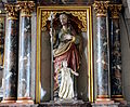 Jousefsstatu Munzen.jpg 3,499 × 2,890; 7.66 MB
-
 Kierch Munzen Agatha.jpg 750 × 1,000; 115 KB
-
 Kierch Munzen bannen.jpg 1,000 × 750; 114 KB
-
 Kierch Munzen baussen.jpg 1,000 × 750; 110 KB
-
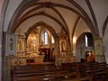
 Kierch Munzen Chouer.jpg 1,000 × 750; 71 KB
-
 Kierch Munzen Fresken.jpg 1,000 × 750; 92 KB
-
 Kierch Munzen Fënster.jpg 750 × 1,000; 84 KB
-
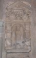 Kierch Munzen Grafsteen.jpg 1,113 × 1,803; 268 KB
-
 Kierch Munzen Hubertus.jpg 750 × 1,000; 164 KB
-
 Kierch Munzen Héichaltor.jpg 750 × 1,000; 115 KB
-
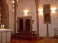
 Kierch Munzen Klierwer Kapell.jpg 750 × 1,000; 72 KB
-
 Kierch Munzen-001.JPG 3,607 × 2,403; 2.07 MB
-
 Kierch Munzen-002.JPG 3,628 × 2,420; 1.92 MB
-
 Kierch Munzen-003.JPG 2,539 × 3,809; 2 MB
-
 Kierch Munzen-004.JPG 3,949 × 2,633; 2.66 MB
-
 Kierch Munzen-005.JPG 3,540 × 2,781; 2.68 MB
-
 Kierch Munzen.JPG 3,771 × 2,513; 1.95 MB
-
 Kirche Munshausen 01.jpg 2,574 × 1,835; 4.28 MB
-
 Kirche Munshausen 02.jpg 2,627 × 1,790; 5.19 MB
-
 Munshausen church.JPG 2,048 × 1,536; 681 KB
-
 Munzen Agathe.jpg 2,388 × 3,578; 5.01 MB
-
 Munzen Beichtstull.jpg 6,296 × 4,501; 17.84 MB
-
 Munzen Fënster Klierfer Kapell.jpg 3,323 × 4,980; 8.27 MB
-
 Munzen Grafsteen.jpg 4,022 × 6,321; 19.74 MB
-
 Munzen Haaptaltor.jpg 4,698 × 7,040; 20.09 MB
-
 Munzen Jousefsaltor.jpg 4,221 × 6,324; 17.79 MB
-
 Munzen Mem 44 45.JPG 2,189 × 2,548; 1.78 MB
-
 Munzen Missiounskräiz.jpg 3,384 × 5,071; 14.33 MB
-
 Munzen Muttergottesaltor.jpg 3,152 × 2,104; 4.78 MB
-
 Sosthène Weis - L'église de Munshausen - 1934.jpg 3,000 × 2,215; 1.1 MB


