
Category:Église Saint-Hubert (Reckange)
| Object location | | View all coordinates using: OpenStreetMap |
|---|
 | |||||
| Upload media | |||||
| Instance of | |||||
|---|---|---|---|---|---|
| Location |
| ||||
 | |||||
Subcategories
This category has only the following subcategory.
Media in category "Église Saint-Hubert (Reckange)"
The following 4 files are in this category, out of 4 total.
-
 27 -27A, rue Principale, Reckange (Mersch) 2024-05.jpg 4,312 × 2,877; 2.75 MB
-
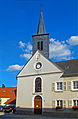
 Hubertuskirche Reckange 01.jpg 1,480 × 1,891; 1.81 MB
-
 Hubertuskirche Reckange 02.jpg 1,353 × 2,065; 1.97 MB
-
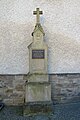 Memorial Reckange 01.jpg 1,365 × 2,048; 2.86 MB
_2024-05.jpg)

