Category:Église Saint-Hubert (Peppange)
Jump to navigation
Jump to search
| Object location | | View all coordinates using: OpenStreetMap |
|---|
 | |||||
| Upload media | |||||
| Instance of | |||||
|---|---|---|---|---|---|
| Location |
| ||||
 | |||||
Subcategories
This category has the following 2 subcategories, out of 2 total.
I
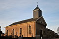
Media in category "Église Saint-Hubert (Peppange)"
The following 2 files are in this category, out of 2 total.
-
 Kierch Peppeng-001.jpg 4,143 × 2,752; 5.62 MB
-
 Kierch Peppeng.jpg 2,213 × 3,332; 3.08 MB
