Category:Église Saint-Hubert (Blaschette)
Jump to navigation
Jump to search
| Object location | | View all coordinates using: OpenStreetMap |
|---|
 | |||||
| Upload media | |||||
| Instance of | |||||
|---|---|---|---|---|---|
| Location |
| ||||
 | |||||
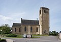
Media in category "Église Saint-Hubert (Blaschette)"
The following 5 files are in this category, out of 5 total.
-
 Blaschette, Hubertusskulptur.jpg 4,058 × 6,080; 18.52 MB
-
 Blaschette, Kierch a Kierfecht.jpg 6,747 × 4,746; 13.21 MB
-
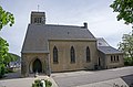 Kirche Blaschette 01.jpg 2,671 × 1,760; 3.68 MB
-
 Kirche Blaschette 02.jpg 2,645 × 1,800; 3.78 MB
-
 Kirche Blaschette 03.jpg 2,638 × 1,800; 3.31 MB


