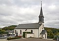
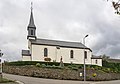
Category:Église Saint-Amand, Selscheid
Jump to navigation
Jump to search
| Object location | | View all coordinates using: OpenStreetMap |
|---|
church building in Luxembourg   | |||||
| Upload media | |||||
| Instance of | |||||
|---|---|---|---|---|---|
| Location |
| ||||
 | |||||
Media in category "Église Saint-Amand, Selscheid"
The following 7 files are in this category, out of 7 total.
-
 Kierch Selschent bannen.jpg 1,000 × 750; 78 KB
-
 Kierch Selschent baussen.jpg 749 × 1,000; 76 KB
-
 Kirche Selscheid 01.jpg 2,624 × 1,810; 3.07 MB
-
 Kirche Selscheid 02.jpg 2,596 × 1,820; 3.17 MB
-
 Kirche Selscheid 03.jpg 1,735 × 2,712; 3.02 MB
-
 Memorial Selscheid 01.jpg 1,790 × 2,618; 4.63 MB
-
 Wiltz, Selscheid (103).jpg 3,569 × 2,008; 1.59 MB


.jpg)