Category:Église Sacré-Cœur, Montreux
Jump to navigation
Jump to search
| Object location | | View all coordinates using: OpenStreetMap |
|---|
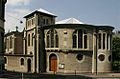
Catholic church in Montreux, Switzerland  Montreux: Catholic Church  | |||||
| Upload media | |||||
| Instance of | |||||
|---|---|---|---|---|---|
| Part of | |||||
| Location | Montreux, Riviera-Pays-d'Enhaut District, canton Vaud, Switzerland | ||||
| Street address |
| ||||
| Heritage designation | |||||
| Inception |
| ||||
| Date of official opening |
| ||||
| Religion or worldview | |||||
| official website | |||||
 | |||||
Media in category "Église Sacré-Cœur, Montreux"
The following 2 files are in this category, out of 2 total.
-
 Eglise du Sacré-Cœur en 2020, période de la pandémie Covid-19.jpg 2,631 × 1,753; 2.5 MB
-
 Picswiss VD-45-15.jpg 500 × 330; 43 KB
Categories:
- Churches in Montreux
- Cultural properties of regional significance in Montreux
- Sacred Heart churches in Switzerland
- Roman Catholic churches in the canton of Vaud in the Roman Catholic Diocese of Lausanne, Geneva and Fribourg
- Churches in Switzerland built in 1885
- Hall churches in Switzerland
- Romanesque Revival churches in Switzerland
- Avenue du Casino (Montreux)