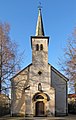
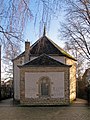
Category:Église Notre-Dame, Salut des Infirmes (Kirchberg)
Jump to navigation
Jump to search
| Object location | | View all coordinates using: OpenStreetMap |
|---|
church building in Luxembourg, Luxembourg  | |||||
| Upload media | |||||
| Instance of | |||||
|---|---|---|---|---|---|
| Location | Kirchberg, Luxembourg, Canton of Luxembourg, Luxembourg | ||||
 | |||||
Media in category "Église Notre-Dame, Salut des Infirmes (Kirchberg)"
The following 10 files are in this category, out of 10 total.
-
 Kierch Kierchbierg Altorraum.jpg 4,128 × 2,322; 2.23 MB
-
 Kierch Kierchbierg Duxall.jpg 4,128 × 2,322; 2.21 MB
-
 Kierch Kierchbierg Tabernakel.jpg 2,322 × 4,128; 2.06 MB
-
 Kierch um Kierchbierg-101.jpg 2,619 × 3,492; 7.72 MB
-
 Kierch um Kierchbierg-102.jpg 1,398 × 1,890; 3.23 MB
-
 Kierch um Kierchbierg-103.jpg 1,379 × 1,517; 798 KB
-
 Kirche Luxemburg-Kirchberg 01.jpg 1,847 × 1,515; 3.17 MB
-
 Kirche Luxemburg-Kirchberg 02.jpg 1,330 × 2,100; 2.51 MB
-
 Kirche Luxemburg-Kirchberg 03.jpg 1,449 × 1,935; 3 MB
-
 Kirche Luxemburg-Kirchberg 04.jpg 1,398 × 2,000; 2.57 MB


