Category:École Edgar-Quinet de Miribel (Ain)
Jump to navigation
Jump to search
| Object location | | View all coordinates using: OpenStreetMap |
|---|
Media in category "École Edgar-Quinet de Miribel (Ain)"
The following 7 files are in this category, out of 7 total.
-
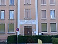
 École communale Garçons Miribel Ain 1.jpg 7,412 × 3,143; 11.23 MB
-
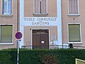
 École communale Garçons Miribel Ain 2.jpg 4,032 × 3,024; 3.56 MB
-
 École communale Garçons Miribel Ain 3.jpg 3,024 × 4,032; 3.08 MB
-
 École communale Garçons Miribel Ain 4.jpg 7,587 × 4,025; 22.25 MB
-
 École communale Garçons Miribel Ain 5.jpg 4,032 × 3,024; 4.4 MB
-
 École communale Garçons Miribel Ain 6.jpg 3,024 × 4,032; 3.87 MB
-
 École Quinet Miribel Ain 1.jpg 5,184 × 3,456; 9.15 MB


