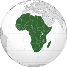
Atlas of Africa

|
Wikimedia Commons Atlas of the World The Wikimedia Atlas of the World is an organized and commented collection of geographical, political and historical maps available at Wikimedia Commons. Discussion • Update the atlas • Index of the Atlas • Atlas in categories • Other atlases on line |
|
|
| ||||||||||||||||||||||||||
General maps
|
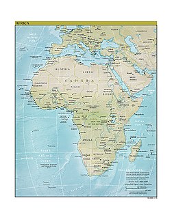
Political map Carte politique |

|
Political map with 1st level divisions as of 1998 in SVG format |
|
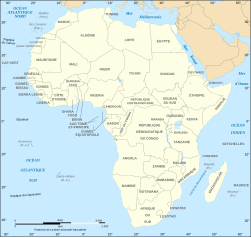
Political map (in French) Carte politique |
|
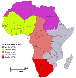
subregion of Africa: |
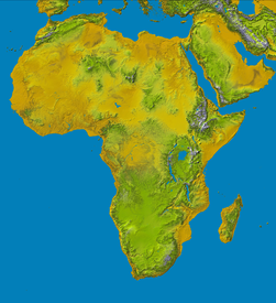
|
Physical map of Africa Carte physique de l'Afrique |

|
Geographical map Carte géographique |

|
Topology map Carte topologique |

|
Blank Map of Africa Fond de carte de l'Afrique (avec frontières étatiques depuis le 9.7.2011) |
Maps of the Middle East
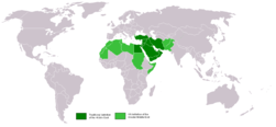
|
Location of the Middle East Localisation du Moyen-Orient الشرق الأوسط |
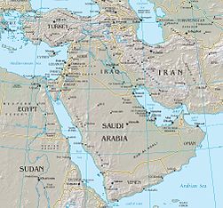
|
Middle East Moyen-Orient الشرق الأوسط |
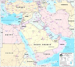
|
Middle East Moyen-Orient الشرق الأوسط |
Current events
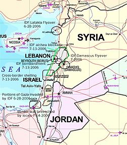
|
The Middle East conflict 2006 |

|
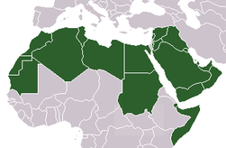
Israel and members of the Arab League (Comoros is not shown) |
History maps
This section holds a short summary of the history of the area of present-day Africa, illustrated with maps, including historical maps of former countries and empires that included present-day Africa.

|
Discovery sites of the Australopitecines |

|
Location of remains of Wilton culture (6000 BCE) |

|
Orient 2000 BC |

|
Map of the Ancient Near East during the Amarna period, showing the great powers of the period: Egypt (green), Hatti (yellow), the Kassites kingdom of Babylon (purple), Assyria (grey), and Mittani (red). Lighter areas show direct control, darker areas represent spheres of influence. The extent of the Achaean/Mycenaean civilization is shown in orange. |

|
Pre-colonial civilizations |
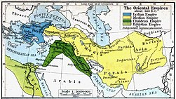
|
Oriental empires 600 BC |

|
Africa in the 13th century |

|
Africa around 1400 |

|
Africa around 1400: kingdoms and trade routes |

|
Africa in the 15th century |
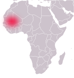
|
The Ghana Empire |

|
The Mali Empire |

|
The Songhai Empire |

|
Explorations of Africa 1857-1863 |
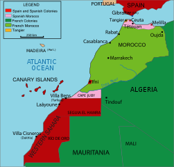
|
Northwestern Africa in 1912 |

|
Colonial Africa in 1913 |

|
Colonial Africa in 1914 |
|
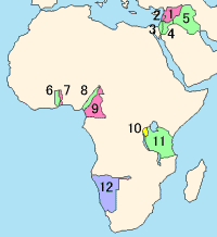
Mandates of the League of Nations |

|
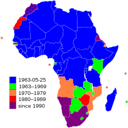
Map with African independence dates |

|
Animated map of independence |
Old maps
This section holds copies of original general maps more than 70 years old.

|
Africa in 1508 |

|
Africa in 1570 (Ortelius) |

|
Africa in 1595 (Mercator) |

|
Map of Africa, ca. 1630 |

|
Africa in 1648 (Blaeu) |

|
West Africa, 1707 (Guillaume Delisle) |

|
Map of Africa by Herman Moll, 1710 |

|
Map of West Africa by Herman Moll, 1729 |

|
Africa in 1737 |

|
West Africa, 1738 |
|
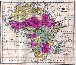
Africa in 1808 |

|
Map of Africa in 1812 |

|
Map of Eastern Africa, 1829 |

|
Routes of European explorers in Africa, to 1853 |

|
Africa in 1861 |

|
Ottoman map of Africa |

|
Senegambia, Andrees Allgemeiner Handatlas, 1st Edition, Leipzig (Germany) 1881, Page 96, Map 1. |

|
Map of Africa in 1890 |

|
Map of Africa in 1897 |

|
Map of Africa in 1898 |

|
Maps in French showing the share of the Lunda kingdom in South-Western Africa (Schrader, Prudent, Anthoine) |

|
Map of Africa in the 1910s |

|
German claims in 1917 |
Maps of international organizations

|
Union africaine African Union الاتحاد الأفريقي União Africana Umoja wa Afrika |
|
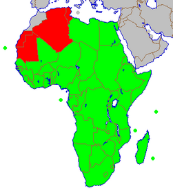
Historical development |
|
African Economic Community |

|
Regional pillars of the African Economic Community |

|
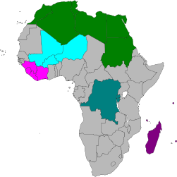
Active regional pillars |
|
Other trade blocs in Africa |
|
جامعة الدول العربية Arab League |
|
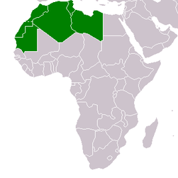
L'Union du Maghreb Arabe Arab Maghreb Union |

|
Conseil de l'Entente Conseil de l'Entente |

|
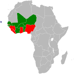
Communauté économique des États de l'Afrique de l'Ouest Comunidade Económica dos Estados da África Ocidental |
|
Currency co-operation in ECOWAS |

|
Southern African Development Community Communauté de développement d’Afrique australe Comunidade para o Desenvolvimento da África Austral |

|
L'Union du Maghreb Arabe Arab Maghreb Union |

|
Communauté des Etats Sahélo-Sahariens تجمع دول الساحل والصحراء Community of Sahel-Saharan States |

|
Commission de l'Océan Indien Indian Ocean Commission |
|
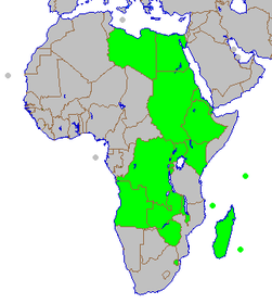
Marché commun de l'Afrique orientale et australe Mercado Comum da África Oriental e Austral Common Market for Eastern and Southern Africa |

|
Jumuiya ya Afrika ya Mashariki East African Community Communauté d'Afrique de l'Est |

|
Communauté Économique des États d'Afrique Centrale Economic Community of Central African States |
|
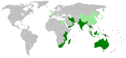
Indian Ocean Rim Association for Regional Cooperation |

|
جامعة الدول العربية
|
Population maps - Cartes démographiques

|
50 largest metropoles of Africa Les 50 metropoles les plus grandes de l'Afrique |

|
Population density Densité de la population |
Ethnic and language maps

|
Languages of Africa Carte linguistique Tale van Afrika |

|
Ethnic groups Groupes ethniques |

|
Language map Carte linguistique |

|
Official languages |

|
Afrique francophone Francophone Africa |
|
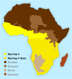
Map showing the approximate distribution of Bantu (dull yellow) vs. other Niger-Congo languages languages and peoples (bright yellow). |

|
One common hypothesis of the Bantu expansion |

|
Nilo-Saharan languages Langues nilo-sahariennes |

|
Khoi-San languages |
|
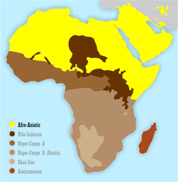
Afro-Asiatic languages Langues afro-asiatiques |
Economical maps

|
National GDP per capita ranges from wealthier states in the north and south to poorer states in the east. These figures from the 2002 World Bank are converted to US dollars. |

|
High index values, indicated by lighter colors, show the relative poverty of African countries as ranked by the UNDP's 2004 list of countries by quality of life. |
Satellite maps

|
Satellite map of Africa Carte satellite de l'Afrique |
Other maps

|
Map of Africa coloured according to the percentage of the Adult (ages 15-49) population with HIV/AIDS. Colour chart available in description. |

|
Africa, top left, populating the other continents in the Paleolithic. |

|
Map in French of Sahara in the Neolithic "wet period", 5000 years ago. |
Notes and references
|
General remarks:
|
