File:Zapadnye gubernii Rossii 1917.png
Jump to navigation
Jump to search

Size of this preview: 611 × 599 pixels. Other resolutions: 245 × 240 pixels | 489 × 480 pixels | 783 × 768 pixels | 1,044 × 1,024 pixels | 2,042 × 2,003 pixels.
Original file (2,042 × 2,003 pixels, file size: 870 KB, MIME type: image/png)
Captions
Captions
Add a one-line explanation of what this file represents
Summary
[edit]

|
This historical map image could be re-created using vector graphics as an SVG file. This has several advantages; see Commons:Media for cleanup for more information. If an SVG form of this image is available, please upload it and afterwards replace this template with
{{vector version available|new image name}}.
It is recommended to name the SVG file “Zapadnye gubernii Rossii 1917.svg”—then the template Vector version available (or Vva) does not need the new image name parameter. |
| Description |
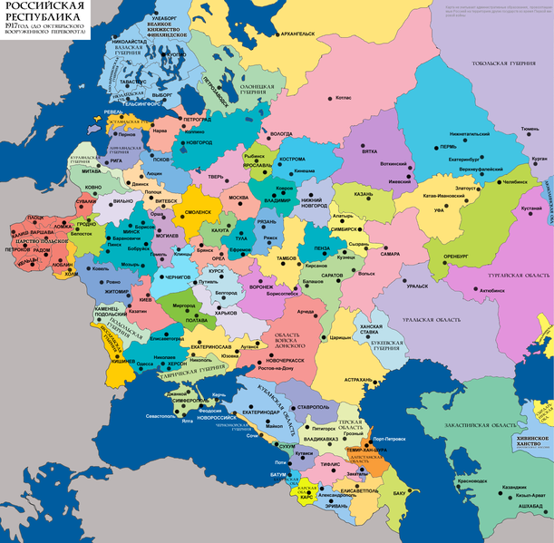
Русский: Административное деление России (западная часть) в 1917 |
| Date |
2008 |
| Source |
Transferred from ru.wikipedia |
| Author |
Николай Сидоров. Original uploader was Nicolay Sidorov at ru.wikipedia. Later version(s) were uploaded by Insider at ru.wikipedia. |
| Permission (Reusing this file) |
Released into the public domain (by the author). |
| Other versions |
Derivative works of this file: |
Licensing
[edit]
| |
This work has been released into the public domain by its author, Nicolay Sidorov, at the English Wikipedia project. This applies worldwide. In case this is not legally possible: |
Original upload log
[edit]
The original description page was here. All following user names refer to ru.wikipedia.
- 2010-06-30 15:02 Nicolay Sidorov 2042×2003× (900806 bytes) Возврат к версии 18:26, 18 января 2009
- 2010-06-30 15:01 Nicolay Sidorov 2042×2003× (900806 bytes) Возврат к версии 18:26, 18 января 2009
- 2010-02-11 12:52 Insider 2042×2003× (1075442 bytes) cleanup watermark
- 2009-01-18 18:26 Nicolay Sidorov 2042×2003× (900806 bytes) {{Изображение | Описание = Карта западных губерний России перед Октябрьским переворотом | Автор = Николай Сидоров | Время создания = 20
- 2008-10-31 10:28 Nicolay Sidorov 2042×2003× (897988 bytes) {{Изображение | Описание = Административное деление России (западная часть) в 1917 | Автор = Николай Сидоров | Время создания = 2008 | Источ�
File history
Click on a date/time to view the file as it appeared at that time.
| Date/Time | Thumbnail | Dimensions | User | Comment | |
|---|---|---|---|---|---|
| current | 14:04, 29 November 2022 | | 2,042 × 2,003 (870 KB) | Well-read MountainMan (talk | contribs) | Скорректированы границы Сухумского округа |
| 06:51, 6 April 2014 |  | 2,042 × 2,003 (1.02 MB) | Nicolay Sidorov (talk | contribs) | + Закатальский и Сухумский округа | |
| 21:17, 5 April 2014 |  | 2,042 × 2,003 (1.03 MB) | Insider (talk | contribs) | Темир-Хан-Шура, а не Порт-Петровск был центром Дагестанской области | |
| 11:15, 18 November 2010 |  | 2,042 × 2,003 (880 KB) | Rubinbot (talk | contribs) | {{BotMoveToCommons|ru.wikipedia|year={{subst:CURRENTYEAR}}|month={{subst:CURRENTMONTHNAME}}|day={{subst:CURRENTDAY}}}} {{Information |Description={{ru|Административное деление России (западная часть) в 1917}} | |
You cannot overwrite this file.
File usage on Commons
The following 2 pages use this file:
File usage on other wikis
The following other wikis use this file:
- Usage on ba.wikipedia.org
- Usage on be.wikipedia.org
- Usage on cs.wikipedia.org
- Usage on cv.wikipedia.org
- Usage on da.wikipedia.org
- Usage on de.wikipedia.org
- Usage on el.wikipedia.org
- Usage on en.wikipedia.org
- Usage on es.wikipedia.org
- Usage on et.wikipedia.org
- Usage on he.wikipedia.org
- Usage on id.wikipedia.org
- Usage on kbd.wiktionary.org
- Usage on lt.wikipedia.org
- Kauno gubernija
- Vilniaus gubernija
- Gardino gubernija
- Vidžemės gubernija
- Minsko gubernija
- Sąrašas:Rusijos imperijos gubernijos
- Suvalkų gubernija
- Kuršo gubernija
- Oulu provincija
- Mažoji Rusija
- Sibiro gubernija
- Estijos gubernija
- Balstogės sritis (1807–1842)
- Lomžos gubernija
- Šiaurės vakarų kraštas
- Liublino gubernija
- Sedlcių gubernija
- Chelmo gubernija
- Šablonas:Rusijos gubernijos
- Novorosija
- Ingrijos gubernija
- Vitebsko gubernija
- Archangelsko gubernija
View more global usage of this file.