File:Zanzibar-north-districts.png
Jump to navigation
Jump to search
Size of this preview: 356 × 600 pixels. Other resolutions: 142 × 240 pixels | 285 × 480 pixels | 750 × 1,264 pixels.
Original file (750 × 1,264 pixels, file size: 25 KB, MIME type: image/png)
Captions
Captions
Add a one-line explanation of what this file represents
Summary[edit]
| Description |
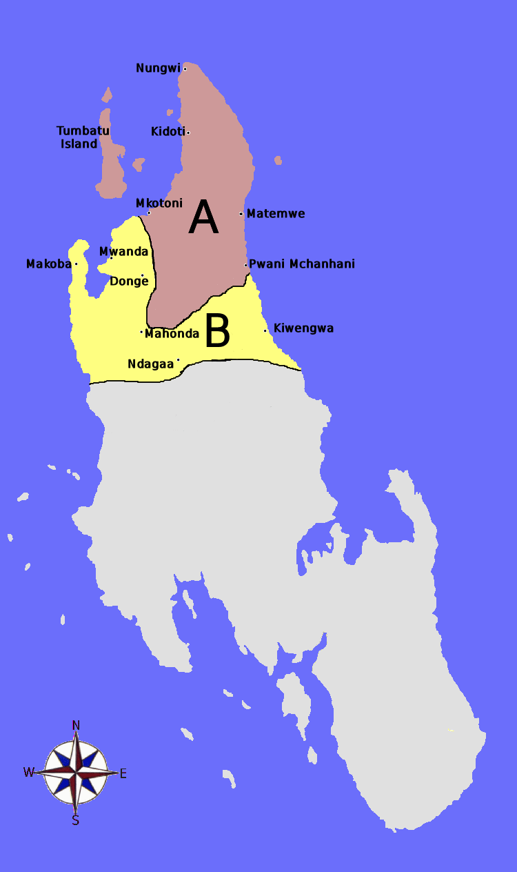
English: Map showing the boundaries and major towns of the Unguja North Region — on Unguja island (Zanzibar Island), Tanzania.
Kiswahili: Ramani ya Mkoa wa Unguja Kaskazini, Jamhuri ya Muungano wa Tanzania.
|
| Date | |
| Source | Own work |
| Author | Bejnar |
Licensing[edit]
I, the copyright holder of this work, hereby publish it under the following license:
This file is licensed under the Creative Commons Attribution-Share Alike 3.0 Unported license.
- You are free:
- to share – to copy, distribute and transmit the work
- to remix – to adapt the work
- Under the following conditions:
- attribution – You must give appropriate credit, provide a link to the license, and indicate if changes were made. You may do so in any reasonable manner, but not in any way that suggests the licensor endorses you or your use.
- share alike – If you remix, transform, or build upon the material, you must distribute your contributions under the same or compatible license as the original.
File history
Click on a date/time to view the file as it appeared at that time.
| Date/Time | Thumbnail | Dimensions | User | Comment | |
|---|---|---|---|---|---|
| current | 18:48, 27 August 2012 | | 750 × 1,264 (25 KB) | Bejnar (talk | contribs) | User created page with UploadWizard |
You cannot overwrite this file.
File usage on Commons
There are no pages that use this file.
File usage on other wikis
The following other wikis use this file:
- Usage on el.wikipedia.org
- Usage on hr.wikipedia.org