File:Wulfhere map.gif
Jump to navigation
Jump to search

Size of this preview: 579 × 599 pixels. Other resolutions: 232 × 240 pixels | 464 × 480 pixels | 771 × 798 pixels.
Original file (771 × 798 pixels, file size: 244 KB, MIME type: image/gif)
Captions
Captions
Add a one-line explanation of what this file represents
| Description |
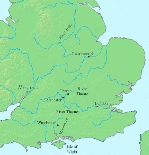
This is a map showing locations relevant to en:Wulfhere of Mercia. The file was created using DMIS. On that site it is stated that "We do not claim copyright on the images, so you can use them for Wikipedia." |
||
| Date | |||
| Source | English Wikipedia | ||
| Author | en:User:Mike Christie | ||
| Permission (Reusing this file) |
|

|
This map image could be re-created using vector graphics as an SVG file. This has several advantages; see Commons:Media for cleanup for more information. If an SVG form of this image is available, please upload it and afterwards replace this template with
{{vector version available|new image name}}.
It is recommended to name the SVG file “Wulfhere map.svg”—then the template Vector version available (or Vva) does not need the new image name parameter. |
File history
Click on a date/time to view the file as it appeared at that time.
| Date/Time | Thumbnail | Dimensions | User | Comment | |
|---|---|---|---|---|---|
| current | 08:54, 5 June 2009 | | 771 × 798 (244 KB) | Filipo (talk | contribs) | {{Information |Description=This is a map showing locations relevant to en:Wulfhere of Mercia. The file was created using [http://www.demis.nl/home/pages/home.htm DMIS]. On that site it is [http://support.demis.nl/forums/thread/1295.aspx stated] tha |
You cannot overwrite this file.
File usage on Commons
There are no pages that use this file.
File usage on other wikis
The following other wikis use this file:
- Usage on ca.wikipedia.org
- Usage on el.wikipedia.org
- Usage on en.wikipedia.org
- Usage on es.wikipedia.org
- Usage on gl.wikipedia.org