File:Winning Coalitions in Italian Regions.svg
Jump to navigation
Jump to search

Size of this PNG preview of this SVG file: 466 × 600 pixels. Other resolutions: 186 × 240 pixels | 373 × 480 pixels | 596 × 768 pixels | 795 × 1,024 pixels | 1,591 × 2,048 pixels.
Original file (SVG file, nominally 800 × 1,030 pixels, file size: 119 KB)
Captions
Captions
Add a one-line explanation of what this file represents
Summary[edit]
| Description |
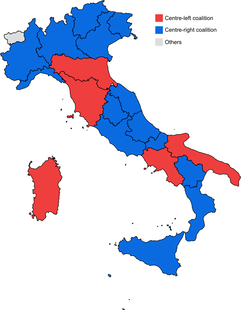
English: Map of the most recent winning coalitions in the twenty Italian regions.
Italiano: Mappa delle più recenti coalizioni vittoriose nelle venti regioni italiane. |
|||
| Date | ||||
| Source | File:Autonomous_Regions_of_Italy.svg | |||
| Author | Foghe | |||
| Permission (Reusing this file) |
I, the copyright holder of this work, hereby publish it under the following license:
|
File history
Click on a date/time to view the file as it appeared at that time.
| Date/Time | Thumbnail | Dimensions | User | Comment | |
|---|---|---|---|---|---|
| current | 15:09, 18 March 2024 | | 800 × 1,030 (119 KB) | Nilo1926 (talk | contribs) | Elezioni regionali in Sardegna del 2024 |
| 18:19, 28 March 2023 |  | 800 × 1,030 (216 KB) | Zio27 (talk | contribs) | Valle d'Aosta in grey | |
| 17:30, 24 March 2023 |  | 800 × 1,030 (216 KB) | Zio27 (talk | contribs) | Lazio has been center-right since 2023 and Val d'Aosta since 2020, [https://elezioni.repubblica.it/2023/elezioni-regionali source] | |
| 14:23, 22 October 2020 |  | 800 × 1,030 (216 KB) | Facquis (talk | contribs) | Update | |
| 22:59, 21 September 2020 |  | 800 × 1,030 (216 KB) | Faustino Sojo (talk | contribs) | Update | |
| 17:54, 16 February 2020 |  | 800 × 1,030 (238 KB) | Facquis (talk | contribs) | Correct colours | |
| 08:29, 27 January 2020 |  | 775 × 915 (89 KB) | Foghe (talk | contribs) | Calabria. | |
| 08:23, 28 October 2019 |  | 775 × 915 (89 KB) | Foghe (talk | contribs) | Umbria. | |
| 06:19, 27 May 2019 |  | 775 × 915 (89 KB) | Foghe (talk | contribs) | Piedmont. | |
| 17:25, 25 March 2019 |  | 775 × 915 (89 KB) | Foghe (talk | contribs) | Basilicata (borders). |
You cannot overwrite this file.
File usage on Commons
The following 17 pages use this file:
- User:J budissin/Uploads/BiH/2019 May 21-31
- User:J budissin/Uploads/BiH/2019 November 1-10
- User:J budissin/Uploads/BiH/2019 October 21-31
- User:J budissin/Uploads/BiH/2020 February 10-19
- User:J budissin/Uploads/BiH/2020 January 21-31
- User:Magog the Ogre/Political maps/2019 May 21-31
- User:Magog the Ogre/Political maps/2019 November 1-10
- User:Magog the Ogre/Political maps/2019 October 21-31
- User:Magog the Ogre/Political maps/2020 February 10-19
- User:Magog the Ogre/Political maps/2020 January 21-31
- User:Magog the Ogre/Political maps/2020 October 21-31
- User:Magog the Ogre/Political maps/2020 September 21-30
- User:Magog the Ogre/Political maps/2023 March 21-31
- User:Magog the Ogre/Political maps/2024 March 11-20
- File:Italian Regions by coalition (2018).svg
- File:Italian Regions by coalition (2019).svg (file redirect)
- File:Italy, provinces by GDP.svg
.svg)
.svg&redirect=no)
File usage on other wikis
The following other wikis use this file:
- Usage on az.wikipedia.org
- Usage on bn.wikipedia.org
- Usage on en.wikipedia.org
- Usage on es.wikipedia.org
- Usage on fr.wikipedia.org
- Usage on it.wikipedia.org