File:Wilton Crescent.jpg
Jump to navigation
Jump to search
No higher resolution available.
Wilton_Crescent.jpg (640 × 480 pixels, file size: 91 KB, MIME type: image/jpeg)
Captions
Captions
Add a one-line explanation of what this file represents
Summary[edit]
| Description |
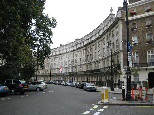
English: Belgravia: Wilton Crescent, SW1 Wilton Crescent, to the north-west of Belgrave Square was laid out in 1827 as part of the new Grosvenor Estate, built on the lands of the Duke of Westminster. The buildings in this part of the crescent were refaced with stone in the early 1900s, making them look different from the stuccoed terraces which are a characteristic feature of the rest of the estate.
The red and white flag is that of the Singaporean High Commission at 9 Wilton Crescent. This view is of the western arc of the crescent. Danny's 213435 shows the eastern arc. |
| Date | |
| Source | From geograph.org.uk |
| Author | Nigel Cox |
| Attribution (required by the license) | Nigel Cox / Belgravia: Wilton Crescent, SW1 / |
| Camera location | | View this and other nearby images on: OpenStreetMap |
|---|
Licensing[edit]

|
This image was taken from the Geograph project collection. See this photograph's page on the Geograph website for the photographer's contact details. The copyright on this image is owned by Nigel Cox and is licensed for reuse under the Creative Commons Attribution-ShareAlike 2.0 license.
|
This file is licensed under the Creative Commons Attribution-Share Alike 2.0 Generic license.
Attribution: Nigel Cox
- You are free:
- to share – to copy, distribute and transmit the work
- to remix – to adapt the work
- Under the following conditions:
- attribution – You must give appropriate credit, provide a link to the license, and indicate if changes were made. You may do so in any reasonable manner, but not in any way that suggests the licensor endorses you or your use.
- share alike – If you remix, transform, or build upon the material, you must distribute your contributions under the same or compatible license as the original.
File history
Click on a date/time to view the file as it appeared at that time.
| Date/Time | Thumbnail | Dimensions | User | Comment | |
|---|---|---|---|---|---|
| current | 14:09, 20 November 2009 | | 640 × 480 (91 KB) | Himalayan Explorer (talk | contribs) | {{Information |Description={{en|1=k}} |Source=k |Author=k |Date=k |Permission= |other_versions= }} |
You cannot overwrite this file.
File usage on Commons
The following page uses this file:
File usage on other wikis
The following other wikis use this file:
- Usage on azb.wikipedia.org
- Usage on de.wikipedia.org
- Usage on en.wikipedia.org
- Usage on it.wikipedia.org
- Usage on ja.wikipedia.org
- Usage on nl.wikipedia.org
- Usage on no.wikipedia.org
- Usage on vi.wikipedia.org
- Usage on www.wikidata.org
- Usage on zh.wikipedia.org