File:Wfm orkney map.png
Jump to navigation
Jump to search

Size of this preview: 515 × 600 pixels. Other resolutions: 206 × 240 pixels | 412 × 480 pixels | 660 × 768 pixels | 879 × 1,024 pixels | 1,851 × 2,155 pixels.
Original file (1,851 × 2,155 pixels, file size: 700 KB, MIME type: image/png)
Captions
Captions
Add a one-line explanation of what this file represents
Summary[edit]
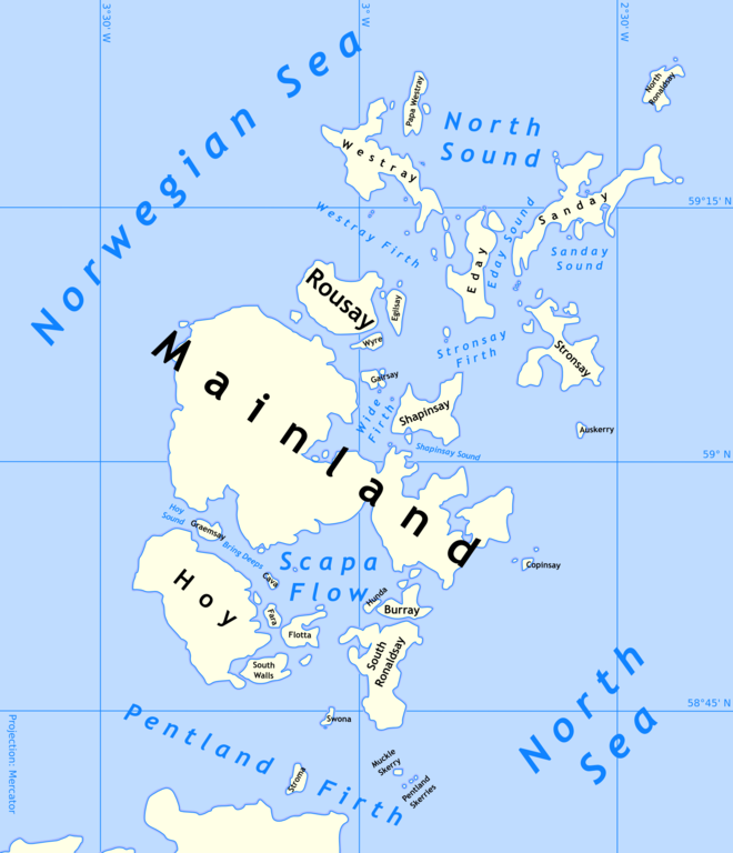
| Description | Outline map of the Orkney Islands in Scotland |
| Date | 24 August 2005 (original upload date) |
| Source | No machine-readable source provided. Own work assumed (based on copyright claims). |
| Author | No machine-readable author provided. Finlay McWalter assumed (based on copyright claims). |
Licensing[edit]
I, the copyright holder of this work, hereby publish it under the following licenses:

|
Permission is granted to copy, distribute and/or modify this document under the terms of the GNU Free Documentation License, Version 1.2 or any later version published by the Free Software Foundation; with no Invariant Sections, no Front-Cover Texts, and no Back-Cover Texts. A copy of the license is included in the section entitled GNU Free Documentation License. |
| This file is licensed under the Creative Commons Attribution-Share Alike 3.0 Unported license. | ||
| ||
| This licensing tag was added to this file as part of the GFDL licensing update. |
You may select the license of your choice.
Rendered using public-domain NOAA World Vector Shoreline (using panmap). The image was then processed and cleaned manually in photoshop, and then imported into Inkscape. In inkscape it was traced to a vector and the colours and labels were added.
TEST VERSION[edit]
- Please don't use this in articles yet - it's subject to radical changes
- Eventually I'll produce transport maps, any historical maps anyone asks me for, and smaller maps which show individual islands highlighted.
File history
Click on a date/time to view the file as it appeared at that time.
| Date/Time | Thumbnail | Dimensions | User | Comment | |
|---|---|---|---|---|---|
| current | 17:39, 24 August 2005 | | 1,851 × 2,155 (700 KB) | Finlay McWalter (talk | contribs) | Outline map of the Orkney Islands in Scotland {{GFDL}} Rendered using public-domain NOAA World Vector Shoreline (using panmap). The image was then processed and cleaned manually in photoshop, and then imported into Inkscape. In inkscape it was traced |
You cannot overwrite this file.
File usage on Commons
There are no pages that use this file.
File usage on other wikis
The following other wikis use this file:
- Usage on af.wikipedia.org
- Usage on ca.wikipedia.org
- Usage on da.wikipedia.org
- Usage on el.wikipedia.org
- Usage on en.wikipedia.org
- Usage on en.wiktionary.org
- Usage on es.wikipedia.org
- Usage on fi.wikipedia.org
- Usage on fr.wiktionary.org
- Usage on he.wikipedia.org
- Usage on it.wikipedia.org
- Usage on nn.wikipedia.org
- Usage on no.wikipedia.org
- Usage on pt.wikipedia.org
- Usage on sh.wikipedia.org