File:Wauldby Dam - geograph.org.uk - 624324.jpg
Jump to navigation
Jump to search
No higher resolution available.
Wauldby_Dam_-_geograph.org.uk_-_624324.jpg (640 × 465 pixels, file size: 150 KB, MIME type: image/jpeg)
Captions
Captions
Add a one-line explanation of what this file represents
Summary
[edit]
| Description |
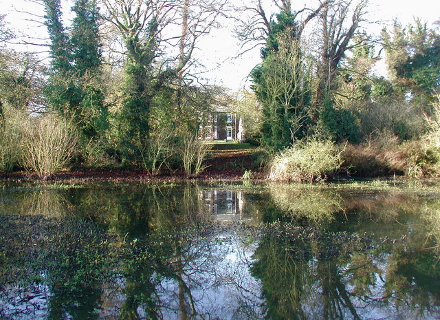
English: Wauldby Dam, Wauldby, East Riding of Yorkshire, England. Looking west across the small lake called Wauldby Dam towards the chapel and farmhouse at Wauldby Manor Farm. Wauldby was a chapelry and township until 1866 and a civil parish until 1st April 1935 when it became part of Welton. Some of the 19th century farm buildings have recently been turned into luxury accommodation. |
| Date | |
| Source | From geograph.org.uk |
| Author | Paul Glazzard |
| Permission (Reusing this file) |
Creative Commons Attribution Share-alike license 2.0 |
| Attribution (required by the license) | Paul Glazzard / Wauldby Dam / |
| Camera location | | View this and other nearby images on: OpenStreetMap |
|---|
_heading:270.00&language=en)
| Object location | | View this and other nearby images on: OpenStreetMap |
|---|
_heading:270.00&language=en)
Licensing
[edit]

|
This image was taken from the Geograph project collection. See this photograph's page on the Geograph website for the photographer's contact details. The copyright on this image is owned by Paul Glazzard and is licensed for reuse under the Creative Commons Attribution-ShareAlike 2.0 license.
|
This file is licensed under the Creative Commons Attribution-Share Alike 2.0 Generic license.
Attribution: Paul Glazzard
- You are free:
- to share – to copy, distribute and transmit the work
- to remix – to adapt the work
- Under the following conditions:
- attribution – You must give appropriate credit, provide a link to the license, and indicate if changes were made. You may do so in any reasonable manner, but not in any way that suggests the licensor endorses you or your use.
- share alike – If you remix, transform, or build upon the material, you must distribute your contributions under the same or compatible license as the original.
File history
Click on a date/time to view the file as it appeared at that time.
| Date/Time | Thumbnail | Dimensions | User | Comment | |
|---|---|---|---|---|---|
| current | 07:35, 7 February 2011 | | 640 × 465 (150 KB) | GeographBot (talk | contribs) | == {{int:filedesc}} == {{Information |description={{en|1=Wauldby Dam Looking west across the small lake called Wauldby Dam towards the chapel and farmhouse at Wauldby Manor Farm. Wauldby was a chapelry and township until 1866 and a civil parish until 1st |
You cannot overwrite this file.
File usage on Commons
There are no pages that use this file.