File:Wasquehal 7 quai des Alliés maison de Maxence Van der Meersch (2).JPG

Original file (3,502 × 2,752 pixels, file size: 5.21 MB, MIME type: image/jpeg)
Captions
Captions
Summary[edit]
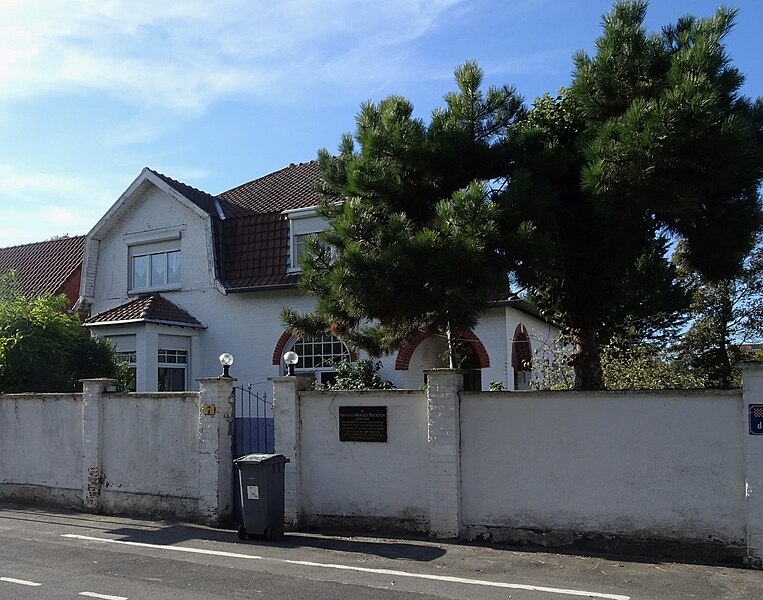
| Description | Wasquehal, 7 quai des Alliés.- La maison où a habité Maxence Van der Meersch | ||||||||||||||||||||
| Date | |||||||||||||||||||||
| Source | Own work | ||||||||||||||||||||
| Author |
|
||||||||||||||||||||
| Permission (Reusing this file) |
|
||||||||||||||||||||
| Other versions |
.JPG) |
||||||||||||||||||||
.jpg)

| Camera location | | View this and other nearby images on: OpenStreetMap |
|---|
Licensing[edit]

|
Permission is granted to copy, distribute and/or modify this document under the terms of the GNU Free Documentation License, Version 1.2 or any later version published by the Free Software Foundation; with no Invariant Sections, no Front-Cover Texts, and no Back-Cover Texts. A copy of the license is included in the section entitled GNU Free Documentation License. |
- You are free:
- to share – to copy, distribute and transmit the work
- to remix – to adapt the work
- Under the following conditions:
- attribution – You must give appropriate credit, provide a link to the license, and indicate if changes were made. You may do so in any reasonable manner, but not in any way that suggests the licensor endorses you or your use.
- share alike – If you remix, transform, or build upon the material, you must distribute your contributions under the same or compatible license as the original.
| Annotations | This image is annotated: View the annotations at Commons |

.JPG&action=edit§ion=1)
.JPG¶ms=050.692421_N_0003.144063_E_globe:Earth_type:camera__&language=en)
.JPG&action=edit§ion=2)
.JPG)

|
This image has been assessed under the valued image criteria and is considered the most valued image on Commons within the scope: Maison de Maxence Van der Meersch (Wasquehal), view from quai des Alliés. You can see its nomination here. |
.JPG)
File history
Click on a date/time to view the file as it appeared at that time.
| Date/Time | Thumbnail | Dimensions | User | Comment | |
|---|---|---|---|---|---|
| current | 16:22, 9 September 2023 | | 3,502 × 2,752 (5.21 MB) | Pierre André Leclercq (talk | contribs) | tilt correction |
| 08:48, 10 October 2018 |  | 3,637 × 2,886 (1.78 MB) | Pierre André Leclercq (talk | contribs) |
You cannot overwrite this file.
File usage on Commons
The following 5 pages use this file:
- User:Paris 16/Recent uploads/2018 October 8-10
- User:Pierre André Leclercq/Gallery/France/Région/Hauts-de-France/Arrondissement de Lille
- User talk:Pierre André Leclercq/Archive 11
- Commons:Valued image candidates/Wasquehal 7 quai des Alliés maison de Maxence Van der Meersch (2).JPG
- Commons:Valued images by topic/Places/Buildings/Cultural
File usage on other wikis
The following other wikis use this file:
- Usage on de.wikipedia.org
- Usage on en.wikipedia.org
- Usage on es.wikipedia.org
- Usage on fr.wikipedia.org
- Usage on it.wikipedia.org
.JPG&oldid=802088479)