File:Voormalige bunker, nu uitzichtpunt. Locatie, Noarderleech 04.jpg
Original file (5,184 × 2,895 pixels, file size: 9.54 MB, MIME type: image/jpeg)
Captions
Summary[edit]
DescriptionVoormalige bunker, nu uitzichtpunt. Locatie, Noarderleech 04.jpg |
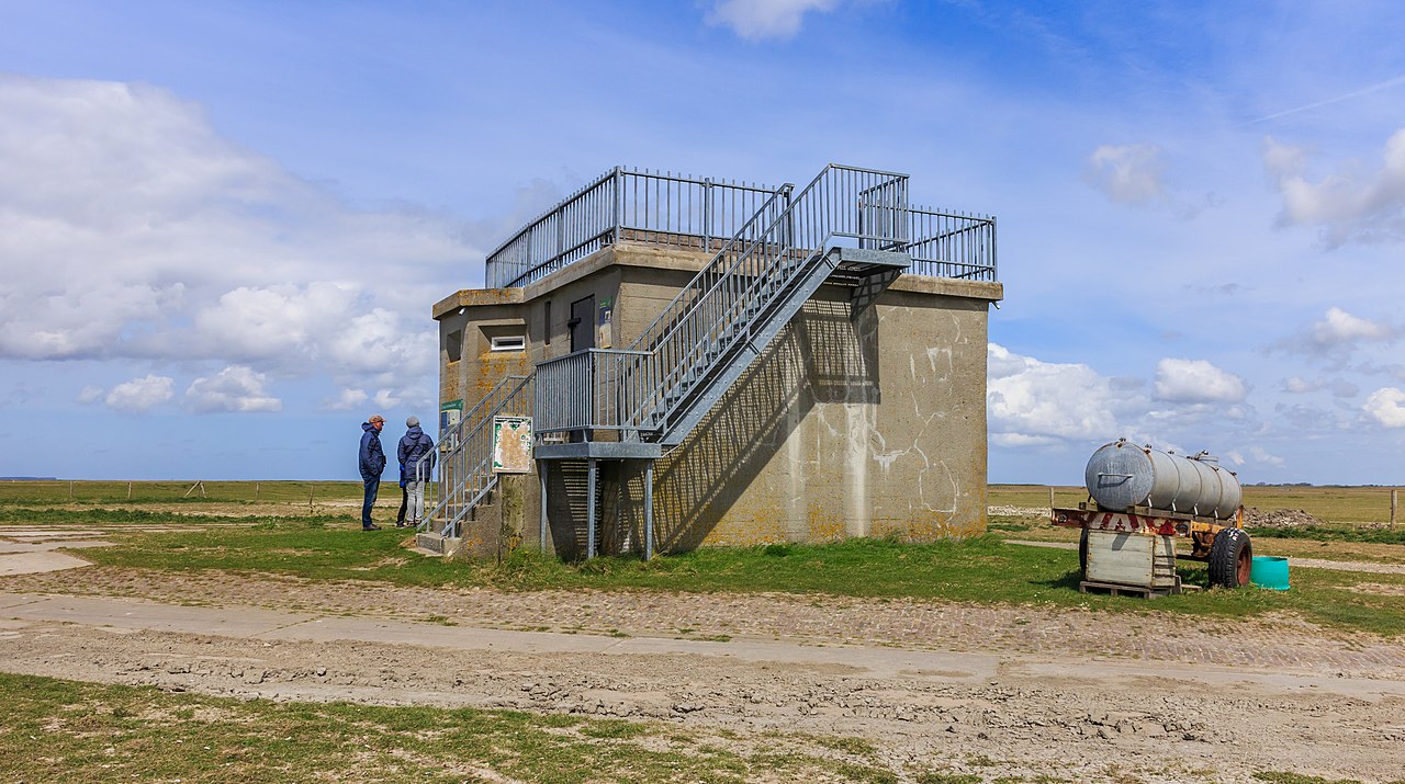
Nederlands: Voormalige bunker, nu uitzichtpunt. Locatie, Noarderleech. English: Former bunker, now viewpoint. Location, Noarderleech. |
Date | |
Source | Own work |
Author | Dominicus Johannes Bergsma |
|
Camera location | 53° 20′ 02.3″ N, 5° 44′ 04.95″ E | View this and other nearby images on: OpenStreetMap | 53.333971; 5.734708 |
---|
Noard-Fryslân Bûtendyks is een uniek natuurgebied van It Fryske Gea. Het bestaat uit zomerpolders, drinkdobben en kwelders. Voor veel vogels een ideaal leefgebied.
English: Noard Friesland Bûtendyks is a unique nature of It Fryske Gea. It consists of summer polders, drink dobben and salt marshes. For many birds an ideal habitat.
Licensing[edit]
- You are free:
- to share – to copy, distribute and transmit the work
- to remix – to adapt the work
- Under the following conditions:
- attribution – You must give appropriate credit, provide a link to the license, and indicate if changes were made. You may do so in any reasonable manner, but not in any way that suggests the licensor endorses you or your use.
- share alike – If you remix, transform, or build upon the material, you must distribute your contributions under the same or compatible license as the original.
This image has been assessed using the Quality image guidelines and is considered a Quality image.
العربية ∙ جازايرية ∙ беларуская ∙ беларуская (тарашкевіца) ∙ български ∙ বাংলা ∙ català ∙ čeština ∙ Cymraeg ∙ Deutsch ∙ Schweizer Hochdeutsch ∙ Zazaki ∙ Ελληνικά ∙ English ∙ Esperanto ∙ español ∙ eesti ∙ euskara ∙ فارسی ∙ suomi ∙ français ∙ galego ∙ עברית ∙ हिन्दी ∙ hrvatski ∙ magyar ∙ հայերեն ∙ Bahasa Indonesia ∙ italiano ∙ 日本語 ∙ Jawa ∙ ქართული ∙ 한국어 ∙ kurdî ∙ Lëtzebuergesch ∙ lietuvių ∙ македонски ∙ മലയാളം ∙ मराठी ∙ Bahasa Melayu ∙ Nederlands ∙ Norfuk / Pitkern ∙ polski ∙ português ∙ português do Brasil ∙ rumantsch ∙ română ∙ русский ∙ sicilianu ∙ slovenčina ∙ slovenščina ∙ shqip ∙ српски / srpski ∙ svenska ∙ தமிழ் ∙ తెలుగు ∙ ไทย ∙ Tagalog ∙ Türkçe ∙ toki pona ∙ українська ∙ vèneto ∙ Tiếng Việt ∙ 中文 ∙ 中文(简体) ∙ 中文(繁體) ∙ +/− |
This image has been assessed under the valued image criteria and is considered the most valued image on Commons within the scope: Former Bunker Noarderleech. You can see its nomination here. |
File history
Click on a date/time to view the file as it appeared at that time.
Date/Time | Thumbnail | Dimensions | User | Comment | |
---|---|---|---|---|---|
current | 16:57, 18 May 2015 | 5,184 × 2,895 (9.54 MB) | Famberhorst (talk | contribs) | User created page with UploadWizard |
You cannot overwrite this file.
File usage on Commons
The following 9 pages use this file:
- User:AbdealiJKTravis/logs/Category Line drawings
- User:Famberhorst/Noard-Fryslân Bûtendyks
- User talk:Famberhorst/Archive 7
- Commons:Quality images/Subject/Architecture/Other/Archive 2015
- Commons:Quality images candidates/Archives June 24 2015
- Commons:Valued image candidates/Voormalige bunker, nu uitzichtpunt. Locatie, Noarderleech 04.jpg
- Commons:Valued images by topic/Places/Buildings/Other
- Category:Bunker Noarderleech
- Category:Noarderleech
File usage on other wikis
The following other wikis use this file:
- Usage on nl.wikipedia.org
- Usage on www.wikidata.org
Metadata
This file contains additional information such as Exif metadata which may have been added by the digital camera, scanner, or software program used to create or digitize it. If the file has been modified from its original state, some details such as the timestamp may not fully reflect those of the original file. The timestamp is only as accurate as the clock in the camera, and it may be completely wrong.
Camera manufacturer | Canon |
---|---|
Camera model | Canon EOS M |
Author | Dominicus Johannes Bergsma |
Exposure time | 1/1,250 sec (0.0008) |
F-number | f/7.1 |
ISO speed rating | 200 |
Date and time of data generation | 15:07, 17 May 2015 |
Lens focal length | 18 mm |
Horizontal resolution | 240 dpi |
Vertical resolution | 240 dpi |
Software used | Adobe Photoshop Lightroom 5.7 (Windows) |
File change date and time | 18:41, 18 May 2015 |
Exposure Program | Aperture priority |
Exif version | 2.3 |
Date and time of digitizing | 15:07, 17 May 2015 |
APEX shutter speed | 10.287712 |
APEX aperture | 5.655638 |
APEX exposure bias | 0 |
Maximum land aperture | 3.625 APEX (f/3.51) |
Metering mode | Pattern |
Flash | Flash did not fire, compulsory flash suppression |
DateTimeOriginal subseconds | 74 |
DateTimeDigitized subseconds | 74 |
Color space | sRGB |
Focal plane X resolution | 5,798.6577181208 |
Focal plane Y resolution | 5,788.9447236181 |
Focal plane resolution unit | inches |
Custom image processing | Normal process |
Exposure mode | Auto exposure |
White balance | Auto white balance |
Scene capture type | Standard |
Serial number of camera | 024052204690 |
Lens used | EF-M18-55mm f/3.5-5.6 IS STM |
Date metadata was last modified | 20:41, 18 May 2015 |
Unique ID of original document | 8558C5A3F00C5E3DCECAFDDDA49A6D26 |
IIM version | 4 |
Structured data
Items portrayed in this file
depicts
some value
17 May 2015
53°20'2.296"N, 5°44'4.949"E
0.0008 second
7.1
18 millimetre
200
image/jpeg
- Quality images
- Valued images
- CC-BY-SA-4.0
- Self-published work
- Valued images sorted by promotion date
- Valued images promoted 2020-11
- Quality images by Famberhorst
- Netherlands photographs taken on 2015-05-17
- Valued images of buildings in the Netherlands
- Valued images of nature
- Valued Images by Famberhorst
- Pages with maps