File:Vitino, RT-70 radio telescope (deep space exploration radar), Extraterrestrial, Crimea.jpg
Jump to navigation
Jump to search

Size of this preview: 800 × 533 pixels. Other resolutions: 320 × 213 pixels | 640 × 427 pixels | 1,024 × 683 pixels | 1,280 × 853 pixels | 2,560 × 1,707 pixels | 3,072 × 2,048 pixels.
Original file (3,072 × 2,048 pixels, file size: 4.08 MB, MIME type: image/jpeg)
Captions
Captions
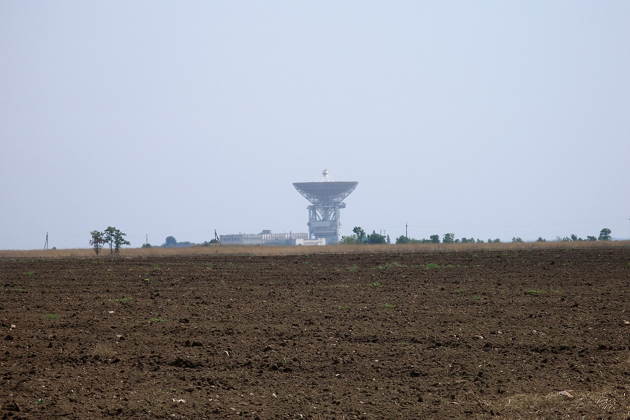
RT-70 radio telescope (deep space exploration radar), Crimea.
Summary[edit]
,_Extraterrestrial,_Crimea.jpg&action=edit§ion=1)
| Description |
English: Evpatoria RT-70 radio telescope (planetary radar, deep space exploration radar) in Crimea is extraterrestrial civilizations ready. The antenna is a powerful planetary transmitter with diameter of 70m and operating range of 5-300 GHz. The telescope participated in almost all of Soviet space programs since 1978 for the exploration of deep space: Venera, Salyut, Vega, Astron, Phobos, Granat, Fobos-Grunt, Spektr-R and more. This telescope has also been used as a radar telescope in observations of space debris and asteroids, and to transmit messages to extraterrestrial civilizations. Up to 100 transmit sessions have been performed to various star destinations in Cygnus, Sagitta, Cassiopeia, Orion, Andromeda, Ursa, Major, Delphinus, Gemini, Virgo, Hydra constellations, with a beam signal power of up to 150 kW at 5 GHz frequency-shift keying. They are all expected to arrive at their destinations in 10 to 50 years. Evpatoria Center for Deep Space Communications and Exploration. Commencing countdown, engines on. Vitino, Crimea.
Русский: Непрекращающиеся сношения с инопланетными цивилизациями с 1978 года. Радиотелескоп РТ-70 (П-2500, 1978), один из самых больших радиотелескопов в мире. 200 киловатт чистой энергии на старте. На данный момент один из двух активных телескопов на планете Земля, способный посылать сигналы по звездам и созвездиям Млечного пути в горизонтах сотен световых лет (тысяч триллионов километров). Центр дальней космической связи (ЦДКС). Витино, Евпатория, Крым. |
| Date | |
| Source | Own work |
| Author | Vyacheslav Argenberg |
| Camera location | | View this and other nearby images on: OpenStreetMap |
|---|
,_Extraterrestrial,_Crimea.jpg¶ms=045.219325_N_0033.174072_E_globe:Earth_type:camera__&language=en)

|
This image was taken by Vyacheslav Argenberg
If you have any questions, comments or queries, please contact me. |

|
Licensing[edit]
,_Extraterrestrial,_Crimea.jpg&action=edit§ion=2)
Vyacheslav Argenberg, the copyright holder of this work, hereby publishes it under the following license:
This file is licensed under the Creative Commons Attribution 4.0 International license.
Attribution: © Vyacheslav Argenberg / http://www.vascoplanet.com/
- You are free:
- to share – to copy, distribute and transmit the work
- to remix – to adapt the work
- Under the following conditions:
- attribution – You must give appropriate credit, provide a link to the license, and indicate if changes were made. You may do so in any reasonable manner, but not in any way that suggests the licensor endorses you or your use.
This image was uploaded as part of Russian Science Photo Competition 2023.
|
File history
Click on a date/time to view the file as it appeared at that time.
| Date/Time | Thumbnail | Dimensions | User | Comment | |
|---|---|---|---|---|---|
| current | 16:35, 18 April 2023 | | 3,072 × 2,048 (4.08 MB) | Argenberg (talk | contribs) | Uploaded own work with UploadWizard |
You cannot overwrite this file.
File usage on Commons
There are no pages that use this file.
File usage on other wikis
The following other wikis use this file:
- Usage on pl.wikipedia.org
,_Extraterrestrial,_Crimea.jpg&oldid=769407264)