File:Views at Ozark National Scenic Riverways, Missouri (213e2651-643e-4ca0-8ba7-0d19dde7f89a).jpg
Jump to navigation
Jump to search

Size of this preview: 800 × 533 pixels. Other resolutions: 320 × 213 pixels | 640 × 427 pixels | 1,024 × 683 pixels | 1,280 × 853 pixels | 2,560 × 1,707 pixels | 3,072 × 2,048 pixels.
Original file (3,072 × 2,048 pixels, file size: 930 KB, MIME type: image/jpeg)
Captions
Captions
Add a one-line explanation of what this file represents
| Camera location | | View this and other nearby images on: OpenStreetMap |
|---|
.jpg¶ms=037.242699_N_-091.355553_E_globe:Earth_type:camera_alt:0_source:exif_&language=en)
Summary[edit]
.jpg&action=edit§ion=1)
| English: Views at Ozark National Scenic Riverways, Missouri | ||||
|---|---|---|---|---|
| Photographer |
English: NPS staff |
|||
| Title |
English: Views at Ozark National Scenic Riverways, Missouri |
|||
| Publisher |
English: National Park Service |
|||
| Description |
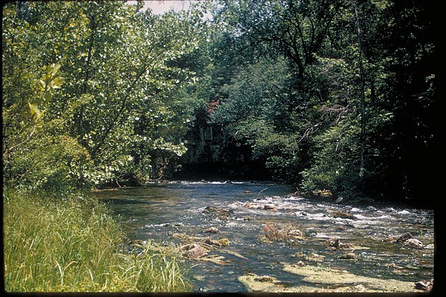
English: Bluffs and river Ozark National Scenic Riverways was created by an Act of Congress on August 24, 1964, to protect 134 miles of the Current and Jacks Fork Rivers in the Ozark Highlands of southeastern Missouri. The clean, clear waters of these two beautiful rivers provide excellent opportunities for johnboating, canoeing, swimming, fishing and tubing. Hunting is also an authorized use within the Riverways' boundaries. The landscape is predominantly rural, with broadleaf forests and occasional open fields.
|
|||
| Depicted place |
English: Ozark National Scenic Riverways, Missouri |
|||
| Date | Taken on 24 February 2004 | |||
| Accession number | ||||
| Source |
English: NPGallery |
|||
| Permission (Reusing this file) |
|
|||
| Sponsor | English: Ozark National Scenic Riverways |
|||
| NPS Unit Code | OZAR | |||
| Legacy NPS Focus Record ID | 231879 | |||
File history
Click on a date/time to view the file as it appeared at that time.
| Date/Time | Thumbnail | Dimensions | User | Comment | |
|---|---|---|---|---|---|
| current | 20:55, 29 June 2019 | | 3,072 × 2,048 (930 KB) | BMacZeroBot (talk | contribs) | Batch upload (Commons:Batch uploading/NPGallery) |
You cannot overwrite this file.
File usage on Commons
The following 3 pages use this file:
.jpg)
.jpg&oldid=752087096)