File:View down NE slope of Little Saughen Brae - geograph.org.uk - 1315616.jpg
Jump to navigation
Jump to search
Size of this preview: 800 × 600 pixels. Other resolutions: 320 × 240 pixels | 640 × 480 pixels | 1,024 × 768 pixels.
Original file (1,024 × 768 pixels, file size: 172 KB, MIME type: image/jpeg)
Captions
Captions
Add a one-line explanation of what this file represents
Summary[edit]
| Description |
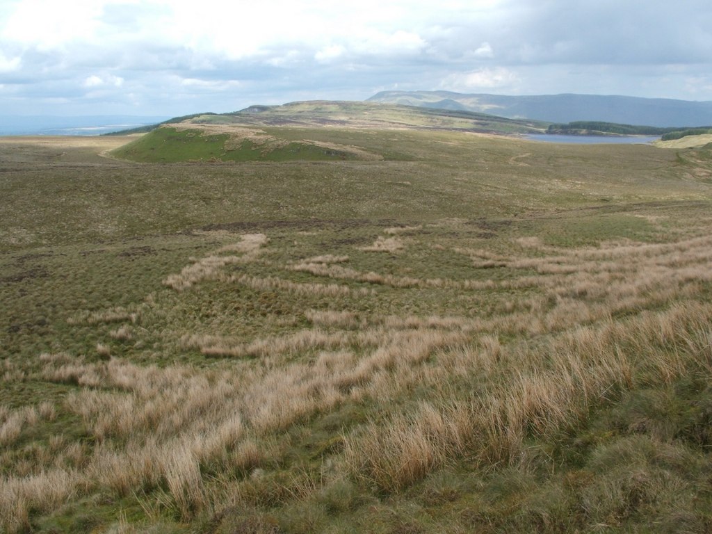
English: View down NE slope of Little Saughen Brae. This is a view down the hillside that is shown here: 1315614.
At the bottom of the slope, the course of the Meikle Saughen Brae Burn can be followed; it appears as a purplish line crossing the image from left to right. On the far side of the burn, left of centre, is Thief's Hill ( https://www.geograph.org.uk/photo/1315291 ); Auchineden Hill is behind it, while the Campsies appear off in the distance in the right-hand side of the photograph. The distant body of water is Burncrooks Reservoir. |
| Date | |
| Source | From geograph.org.uk |
| Author | Lairich Rig |
| Attribution (required by the license) | Lairich Rig / View down NE slope of Little Saughen Brae / |
| Camera location | | View this and other nearby images on: OpenStreetMap |
|---|
_heading:45.00&language=en)
| Object location | | View this and other nearby images on: OpenStreetMap |
|---|
_heading:45.00&language=en)
Licensing[edit]

|
This image was taken from the Geograph project collection. See this photograph's page on the Geograph website for the photographer's contact details. The copyright on this image is owned by Lairich Rig and is licensed for reuse under the Creative Commons Attribution-ShareAlike 2.0 license.
|
This file is licensed under the Creative Commons Attribution-Share Alike 2.0 Generic license.
Attribution: Lairich Rig
- You are free:
- to share – to copy, distribute and transmit the work
- to remix – to adapt the work
- Under the following conditions:
- attribution – You must give appropriate credit, provide a link to the license, and indicate if changes were made. You may do so in any reasonable manner, but not in any way that suggests the licensor endorses you or your use.
- share alike – If you remix, transform, or build upon the material, you must distribute your contributions under the same or compatible license as the original.
File history
Click on a date/time to view the file as it appeared at that time.
| Date/Time | Thumbnail | Dimensions | User | Comment | |
|---|---|---|---|---|---|
| current | 21:00, 8 September 2017 | | 1,024 × 768 (172 KB) | Geograph Update Bot (talk | contribs) | Higher-resolution version from Geograph. |
| 18:52, 27 February 2011 |  | 640 × 480 (70 KB) | GeographBot (talk | contribs) | == {{int:filedesc}} == {{Information |description={{en|1=View down NE slope of Little Saughen Brae This is a view down the hillside that is shown here: 1315614. At the bottom of the slope, the course of the Meikle Saughen Brae Burn can be followed; |
You cannot overwrite this file.
File usage on Commons
There are no pages that use this file.