File:Vicinity of Mohacs.png
Jump to navigation
Jump to search
Size of this preview: 453 × 600 pixels. Other resolutions: 181 × 240 pixels | 362 × 480 pixels | 580 × 768 pixels | 773 × 1,024 pixels | 1,547 × 2,048 pixels | 2,983 × 3,950 pixels.
Original file (2,983 × 3,950 pixels, file size: 24.98 MB, MIME type: image/png)
Captions
Captions
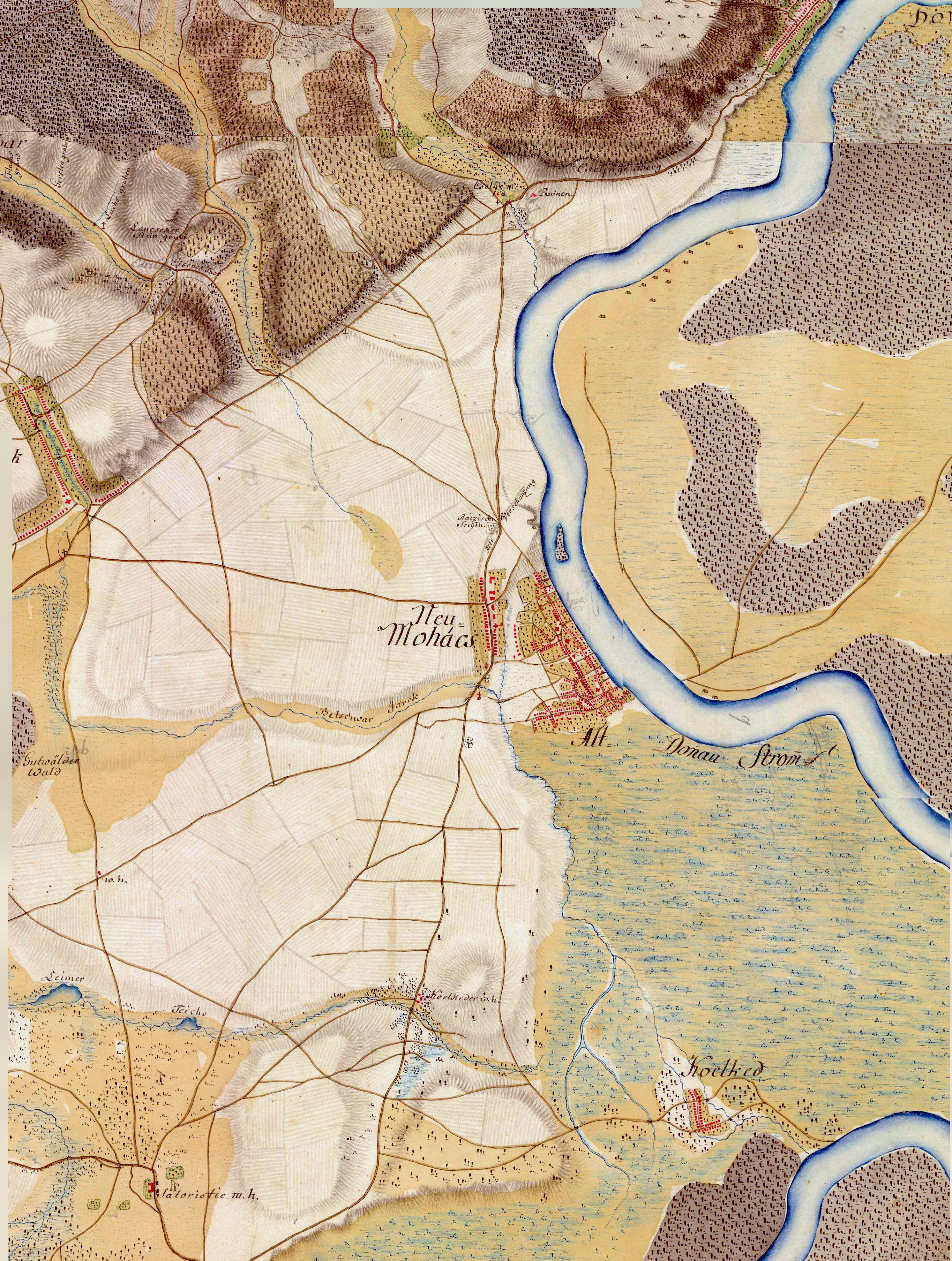
Mohacs from the First Military Survey Habsburg Empire (1763-1787)
Summary[edit]
| Description |
English: The area where the Battle of Mohács happened in 1526. |
| Date | |
| Source | First Military Mapping Survey of Austrian Empire (1764 – 1768), called „Josephinische Landesaufnahme“ |
| Author | unkown |
| Camera location | | View this and other nearby images on: OpenStreetMap |
|---|
Licensing[edit]
|
This work is in the public domain in its country of origin and other countries and areas where the copyright term is the author's life plus 70 years or fewer. This work is in the public domain in the United States because it was published (or registered with the U.S. Copyright Office) before January 1, 1929. | |
| This file has been identified as being free of known restrictions under copyright law, including all related and neighboring rights. | |
File history
Click on a date/time to view the file as it appeared at that time.
| Date/Time | Thumbnail | Dimensions | User | Comment | |
|---|---|---|---|---|---|
| current | 00:05, 29 September 2023 | | 2,983 × 3,950 (24.98 MB) | Ovo.Je.Istina (talk | contribs) | Improved the color, add more blue |
| 23:54, 28 September 2023 |  | 2,983 × 3,950 (23.98 MB) | Ovo.Je.Istina (talk | contribs) | Uploaded a work by unkown from First Military Mapping Survey of Austrian Empire (1764 – 1768), called „Josephinische Landesaufnahme“ with UploadWizard |
You cannot overwrite this file.
File usage on Commons
There are no pages that use this file.