File:Verzweigung Zürich-West, location on 25000 map by Swisstopo, 2013.jpg
Jump to navigation
Jump to search

Size of this preview: 615 × 600 pixels. Other resolutions: 246 × 240 pixels | 492 × 480 pixels | 788 × 768 pixels | 1,050 × 1,024 pixels | 1,643 × 1,602 pixels.
Original file (1,643 × 1,602 pixels, file size: 422 KB, MIME type: image/jpeg)
Captions
Captions
Add a one-line explanation of what this file represents
Summary[edit]
| Description |
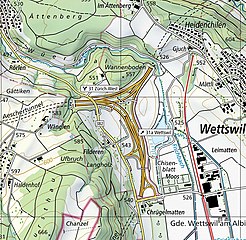
English: Verzweigung Zürich-West, location on Swiss national map 1:25'000, sheet 1091 Zürich. |
|||||||||||||||||||||||
| Date | ||||||||||||||||||||||||
| Source |
|
|||||||||||||||||||||||
| Author |
|
|||||||||||||||||||||||
| Other versions | ||||||||||||||||||||||||


| Object location | | View this and other nearby images on: OpenStreetMap |
|---|
Licensing[edit]
The data made publicly available by swisstopo may be used, distributed and made accessible. Furthermore, they may be enriched and processed and also used commercially. A reference to the source is mandatory. In the case of digital or analogue representations and publications, as well as in the case of dissemination, one of the following source references must be attached in any case:
Terms of use for free geodata and geoservices (OGD) from swisstopo
|
.svg) |
File history
Click on a date/time to view the file as it appeared at that time.
| Date/Time | Thumbnail | Dimensions | User | Comment | |
|---|---|---|---|---|---|
| current | 10:31, 27 April 2022 | | 1,643 × 1,602 (422 KB) | Enhancing999 (talk | contribs) | File:1091 Zürich.jpg cropped 88 % horizontally, 83 % vertically using CropTool with precise mode. |
You cannot overwrite this file.
File usage on Commons
The following page uses this file: