File:Verbindungsbruecke Hafen Bremerhaven.jpg
Jump to navigation
Jump to search

Size of this preview: 800 × 600 pixels. Other resolutions: 320 × 240 pixels | 640 × 480 pixels | 960 × 720 pixels.
Original file (960 × 720 pixels, file size: 445 KB, MIME type: image/jpeg)
Captions
Captions
Add a one-line explanation of what this file represents
Summary
[edit]
| Description |
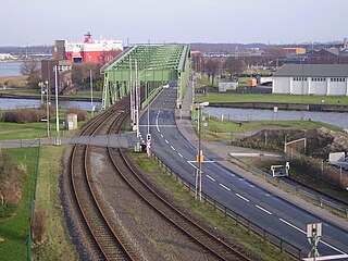
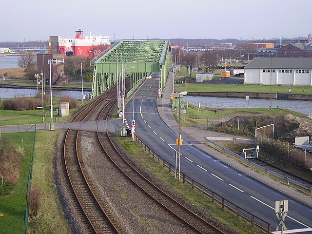
Deutsch: Verbindungsbrücke (Drehbrücke) für Straßen- und Schienenverkehr in Bremerhaven zwischen dem Wendebecken am Nordhafen und den Kaiserhäfen |
| Date | |
| Source | Own work |
| Author | Garitzko |
| Camera location | | View this and other nearby images on: OpenStreetMap |
|---|

|
This is one of the images forming part of the Valued image set: Swing bridge on Wikimedia Commons. The image set has been assessed under the valued image set criteria and is considered the most valued set on Commons within the scope:
You can see its nomination at Commons:Valued image candidates/Swing bridge. |
Licensing
[edit]
| I, the copyright holder of this work, release this work into the public domain. This applies worldwide. In some countries this may not be legally possible; if so: I grant anyone the right to use this work for any purpose, without any conditions, unless such conditions are required by law. |
File history
Click on a date/time to view the file as it appeared at that time.
| Date/Time | Thumbnail | Dimensions | User | Comment | |
|---|---|---|---|---|---|
| current | 18:12, 1 November 2008 | | 960 × 720 (445 KB) | Garitzko (talk | contribs) | {{Information |Description={{de|1=Verbindungsbrücke (Drehbrücke) für Straßen- und Schienenverkehr in Bremerhaven zwischen dem Wendebecken am Nordhafen und den Kaiserhäfen}} |Source=Eigenes Werk (own work) |Author=Garitzko |Date=Dece |
You cannot overwrite this file.
File usage on Commons
The following 2 pages use this file: