File:V Piknik Kawaleryjski - Bliżyn - 14051967552 WWII reenactment reenactors Wehrmacht Heer Army of Nazi Germany replicas of uniforms equipment military weapons motorcycle Poland forest 2014-04-27.jpg
Jump to navigation
Jump to search

Size of this preview: 800 × 530 pixels. Other resolutions: 320 × 212 pixels | 640 × 424 pixels | 1,024 × 678 pixels | 1,280 × 848 pixels | 2,560 × 1,696 pixels | 4,928 × 3,264 pixels.
Original file (4,928 × 3,264 pixels, file size: 2.81 MB, MIME type: image/jpeg)
Captions
Captions
Add a one-line explanation of what this file represents
Summary[edit]
| Description |
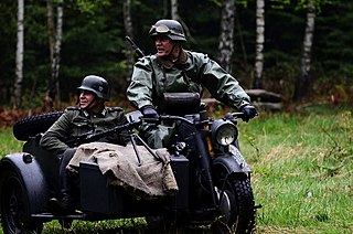
English: Polish reenactors dressed in replica uniforms and equipped with field gear and weapons used by the Wehrmacht Heer, the army of Nazi Germany, during a historical reenactment of a battle fought between German and Polish military forces in 1939 at the beginning of the Second World War. Motorcylicists on military motorbike with armed sidecar, etc.
|
| Date | |
| Source | https://www.flickr.com/photos/jcubic/14051967552/ |
| Author | Jakub T. Jankiewicz |
| Camera location | | View this and other nearby images on: OpenStreetMap |
|---|
Licensing[edit]
This file is licensed under the Creative Commons Attribution-Share Alike 2.0 Generic license.
- You are free:
- to share – to copy, distribute and transmit the work
- to remix – to adapt the work
- Under the following conditions:
- attribution – You must give appropriate credit, provide a link to the license, and indicate if changes were made. You may do so in any reasonable manner, but not in any way that suggests the licensor endorses you or your use.
- share alike – If you remix, transform, or build upon the material, you must distribute your contributions under the same or compatible license as the original.
| This image was originally posted to Flickr by jcubic at https://flickr.com/photos/56196558@N08/14051967552. It was reviewed on 4 March 2023 by FlickreviewR 2 and was confirmed to be licensed under the terms of the cc-by-sa-2.0. |
File history
Click on a date/time to view the file as it appeared at that time.
| Date/Time | Thumbnail | Dimensions | User | Comment | |
|---|---|---|---|---|---|
| current | 14:17, 4 March 2023 | | 4,928 × 3,264 (2.81 MB) | Wolfmann (talk | contribs) | Uploaded a work by Jakub T. Jankiewicz from https://www.flickr.com/photos/jcubic/14051967552/ with UploadWizard |
You cannot overwrite this file.
File usage on Commons
The following page uses this file: