File:Upana 2000-07-21 0600Z.jpg
Jump to navigation
Jump to search

Size of this preview: 718 × 599 pixels. Other resolutions: 288 × 240 pixels | 575 × 480 pixels | 920 × 768 pixels.
Original file (920 × 768 pixels, file size: 293 KB, MIME type: image/jpeg)
Captions
Captions
Add a one-line explanation of what this file represents
Summary[edit]
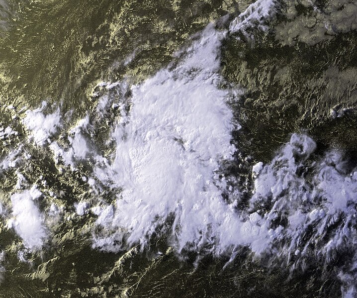
| Description | 01C had strengthened to become Tropical Storm Upana. Upana was located south-southeast of Hawaii near 10.2N 151.4W at 6:00 UTC. The storm had been moving in a westerly direction at 11 knots with maximum sustained winds estimated at 40 knots, gusts to 50 knots. | |||
| Date | ||||
| Source | http://www.osei.noaa.gov/Events/Tropical/E_Pacific/2000/TRCupana203_G10.jpg | |||
| Author | GOES-10 from NOAA Satellite and Information Service | |||
| Permission (Reusing this file) |
|
File history
Click on a date/time to view the file as it appeared at that time.
| Date/Time | Thumbnail | Dimensions | User | Comment | |
|---|---|---|---|---|---|
| current | 01:24, 21 September 2006 | | 920 × 768 (293 KB) | Good kitty (talk | contribs) | == Summary == {{Information |Description=01C had strengthened to become Tropical Storm Upana. Upana was located south-southeast of Hawaii near 10.2N 151.4W at 6:00 UTC. The storm had been moving in a westerly direction at 11 knots with maximum sustained w |
You cannot overwrite this file.
File usage on Commons
The following page uses this file:
- File:TS Upana 2000.jpg (file redirect)
File usage on other wikis
The following other wikis use this file:
- Usage on en.wikipedia.org
- Usage on zh.wikipedia.org