File:Unteres Recknitztal, Ahrenshagen-Daskow (LRM 20200517 164049-hdr-Pano).jpg
Jump to navigation
Jump to search

Size of this preview: 800 × 322 pixels. Other resolutions: 320 × 129 pixels | 640 × 258 pixels | 1,024 × 412 pixels | 1,280 × 515 pixels | 2,560 × 1,030 pixels | 5,157 × 2,075 pixels.
Original file (5,157 × 2,075 pixels, file size: 5.91 MB, MIME type: image/jpeg)
Captions
Captions
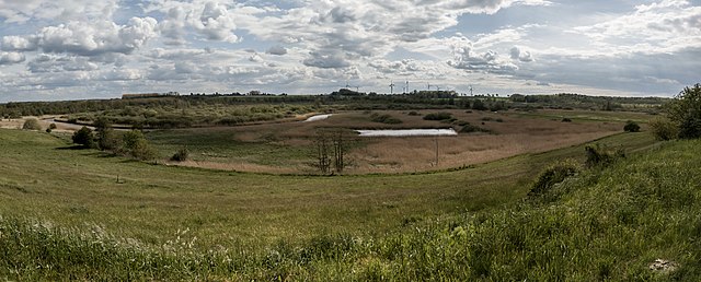
Panoramic view of the Recknitz Valley landscape protection area and nature reserve Torfstichgelände Bei Carlewitz from Daskow
Summary[edit]
.jpg&action=edit§ion=1)
| Description |
English: Panoramic view of the Recknitz Valley landscape protection area and nature reserve Torfstichgelände Bei Carlewitz from Daskow
|
||||
| Date | |||||
| Source | Own work | ||||
| Author | MB-one |
| Camera location | | View this and other nearby images on: OpenStreetMap |
|---|
.jpg¶ms=054.232159_N_0012.532289_E_globe:Earth_type:camera_heading:180.00&language=en)
| Supported by Wikimedia Deutschland: Adobe Lightroom |
|---|
Die Bearbeitung und Verwaltung dieser Datei wurde von Wikimedia Deutschland durch ein Software-Stipendium für Adobe Photoshop Lightroom unterstützt.
|
Licensing[edit]
.jpg&action=edit§ion=2)
I, the copyright holder of this work, hereby publish it under the following license:
This file is licensed under the Creative Commons Attribution-Share Alike 4.0 International license.
- You are free:
- to share – to copy, distribute and transmit the work
- to remix – to adapt the work
- Under the following conditions:
- attribution – You must give appropriate credit, provide a link to the license, and indicate if changes were made. You may do so in any reasonable manner, but not in any way that suggests the licensor endorses you or your use.
- share alike – If you remix, transform, or build upon the material, you must distribute your contributions under the same or compatible license as the original.
This image was uploaded as part of Wiki Loves Earth 2020.
|
 |
File history
Click on a date/time to view the file as it appeared at that time.
| Date/Time | Thumbnail | Dimensions | User | Comment | |
|---|---|---|---|---|---|
| current | 21:08, 20 May 2020 | 5,157 × 2,075 (5.91 MB) | MB-one (talk | contribs) | Uploaded own work with UploadWizard |
You cannot overwrite this file.
File usage on Commons
The following page uses this file:
File usage on other wikis
The following other wikis use this file:
- Usage on de.wikipedia.org
- Usage on www.wikidata.org
.jpg&oldid=750921886)