File:Uk outline map with WCML railway.PNG
Jump to navigation
Jump to search
Size of this preview: 450 × 600 pixels. Other resolutions: 180 × 240 pixels | 600 × 800 pixels.
Original file (600 × 800 pixels, file size: 40 KB, MIME type: image/png)
Captions
Captions
Add a one-line explanation of what this file represents
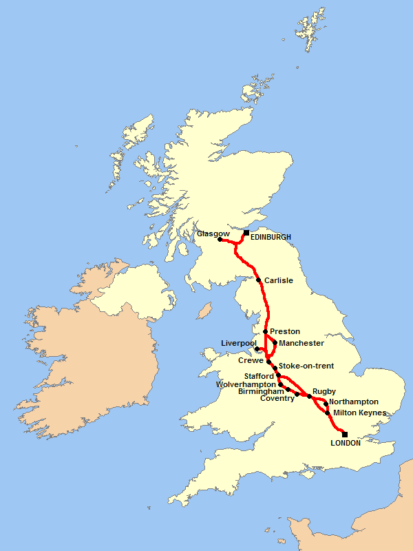
| Description | A blank map of the United Kingdom, with the route of the West Coast Main Line railway shown. |
| Date | (UTC) |
| Source | |
| Author |
|
| This is a retouched picture, which means that it has been digitally altered from its original version. Modifications: Added railway route to map. The original can be viewed here: Uk outline map.png:
|
I, the copyright holder of this work, hereby publish it under the following licenses:
| This file is licensed under the Creative Commons Attribution-Share Alike 3.0 Unported license. | ||
| ||
| This licensing tag was added to this file as part of the GFDL licensing update. |

|
Permission is granted to copy, distribute and/or modify this document under the terms of the GNU Free Documentation License, Version 1.2 or any later version published by the Free Software Foundation; with no Invariant Sections, no Front-Cover Texts, and no Back-Cover Texts. A copy of the license is included in the section entitled GNU Free Documentation License. |
You may select the license of your choice.
Original upload log[edit]
This image is a derivative work of the following images:
- File:Uk_outline_map.png licensed with Cc-by-sa-3.0-migrated, GFDL
- 2007-03-31T00:14:54Z Tene 600x800 (8902 Bytes) Optimised (0;r); I removed the (new) alpha channel - I've no idea why the previous uploader added it.
- 2007-03-15T11:54:05Z Hoshie 600x800 (33438 Bytes) Fixed map to show that the Channel Islands and the Isle of Man are NOT a part of the UK - they are Crown Dependencies!
- 2007-02-19T23:50:46Z Tene 600x800 (9236 Bytes) Optimised (0;1024)
- 2006-10-14T17:03:10Z Nichtbesserwisser 600x800 (11855 Bytes) == Summary == {{Information| |Description=A blank map of the United Kingdom, with country outline and coastline; contact the author for help with modifications or add-ons |Source=Reference map provided by Demis Mapper 6 |Date
Uploaded with derivativeFX
File history
Click on a date/time to view the file as it appeared at that time.
| Date/Time | Thumbnail | Dimensions | User | Comment | |
|---|---|---|---|---|---|
| current | 00:27, 15 March 2010 | | 600 × 800 (40 KB) | Abc30 (talk | contribs) | {{Information |Description=A blank map of the United Kingdom, with the route of the West Coast Main Line railway shown. |Source=*File:Uk_outline_map.png |Date=2010-03-15 00:27 (UTC) |Author=*File:Uk_outline_map.png: ChrisO |
You cannot overwrite this file.
File usage on Commons
There are no pages that use this file.
File usage on other wikis
The following other wikis use this file:
- Usage on en.wikipedia.org