File:US-luftbild 1945 wuerzburg festung no.7078.jpg
Jump to navigation
Jump to search

Size of this preview: 604 × 599 pixels. Other resolutions: 242 × 240 pixels | 484 × 480 pixels | 774 × 768 pixels | 1,032 × 1,024 pixels | 1,598 × 1,585 pixels.
Original file (1,598 × 1,585 pixels, file size: 735 KB, MIME type: image/jpeg)
Captions
Captions
Add a one-line explanation of what this file represents
Summary[edit]
| Description |
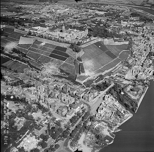
English: Aerial photo of the destroyed fortress of Würzburg in autumn 1945, taken from the south
Deutsch: Luftbild von der zerstörten Festung Marienberg im Herbst 1945, aufgenommen von Süden |
| Date | |
| Source | www.luftbilddatenbank.de |
| Author | USAAF |
| Camera location | | View this and other nearby images on: OpenStreetMap |
|---|
Licensing[edit]
This image or file is a work of a U.S. Air Force Airman or employee, taken or made as part of that person's official duties. As a work of the U.S. federal government, the image or file is in the public domain in the United States.
|
 |
| Annotations | This image is annotated: View the annotations at Commons |
File history
Click on a date/time to view the file as it appeared at that time.
| Date/Time | Thumbnail | Dimensions | User | Comment | |
|---|---|---|---|---|---|
| current | 12:41, 25 June 2011 | | 1,598 × 1,585 (735 KB) | Drdoht (talk | contribs) | {{Information |Description ={{en|1=Aerial photo of the destroyed fortress of Würzburg in autumn 1945, taken from the south}} {{de|1=Luftbild von der zerstörten Festung Marienberg im Herbst 1945, aufgenommen von Süden}} |Source =www.luftb |
You cannot overwrite this file.
File usage on Commons
There are no pages that use this file.
File usage on other wikis
The following other wikis use this file:
- Usage on de.wikipedia.org