File:UEFA Euro 2012 cs.png
UEFA_Euro_2012_cs.png (800 × 511 pixels, file size: 14 KB, MIME type: image/png)
Captions
Captions
| Description |
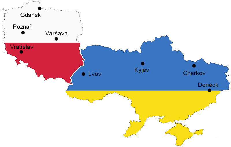
Euro 2012 venues, based on UN East Europe map. Other versions: German: Image:UEFA Euro 2012 de.svg Polish: Image:UEFA Euro 2012 pl.svg Ukrainian: Image:UEFA Euro 2012 uk.svg Romanian: Image:UEFA Euro 2012 ro.svg Čeština: Image:UEFA Euro 2012 cs.png |
| Date | (UTC) |
| Source | |
| Author |
|
| This is a retouched picture, which means that it has been digitally altered from its original version. The original can be viewed here: UEFA Euro 2012 en.svg:
|
| I, the copyright holder of this work, release this work into the public domain. This applies worldwide. In some countries this may not be legally possible; if so: I grant anyone the right to use this work for any purpose, without any conditions, unless such conditions are required by law. |
| This image is a map derived from a United Nations map.
Unless stated otherwise, UN maps are to be considered in the public domain. This applies worldwide. UN maps are, in principle, open source material and you can use them in your work or for making your own map. UN requests however that you delete the UN name, logo and reference number upon any modification to the map. Content of your map will be your responsibility. You can state in your publication, if you wish, something like: based on UN map … (map name, map number, revision number and date). See: Geospatial Information Section. And: Geospatial, location data for a better world. |
 |
Original upload log[edit]
This image is a derivative work of the following images:
- File:UEFA_Euro_2012_en.svg licensed with PD-self, UN map
- 2009-10-11T07:25:56Z Sliwers 1000x639 (182233 Bytes) Only cities that have been selected or may be selected.
- 2007-04-22T11:48:05Z Akhristov 1000x639 (223199 Bytes) Fonts to paths, plain SVG.
- 2007-04-22T11:44:51Z Akhristov 1000x639 (156188 Bytes) {{Information| |Description=Euro 2012 venues, based on UN East Europe map. |Source=http://www.un.org/Depts/Cartographic/map/profile/easteuro.pdf |Date=2004, April 2007 |Author=United Nations Cartographic Section, Alex Khristo
Uploaded with derivativeFX
File history
Click on a date/time to view the file as it appeared at that time.
| Date/Time | Thumbnail | Dimensions | User | Comment | |
|---|---|---|---|---|---|
| current | 12:43, 23 September 2010 | | 800 × 511 (14 KB) | Jan Polák (talk | contribs) | Doplnění kolečka u města Gdaňsk. |
| 12:10, 23 September 2010 |  | 800 × 511 (14 KB) | Jan Polák (talk | contribs) | {{Information |Description=Euro 2012 venues, based on UN East Europe map.<br />Other versions:<br />German: Image:UEFA Euro 2012 de.svg<br />Polish: Image:UEFA Euro 2012 pl.svg<br />Ukrainian: Image:UEFA Euro 2012 uk.svg<br />Romanian: [[:I |
You cannot overwrite this file.
File usage on Commons
The following page uses this file:
File usage on other wikis
The following other wikis use this file:
- Usage on cs.wikipedia.org