File:Two-point Equidistant with Tissot's Indicatrices of Distortion.svg
Jump to navigation
Jump to search

Size of this PNG preview of this SVG file: 621 × 600 pixels. Other resolutions: 249 × 240 pixels | 497 × 480 pixels | 795 × 768 pixels | 1,060 × 1,024 pixels | 2,121 × 2,048 pixels | 1,600 × 1,545 pixels.
Original file (SVG file, nominally 1,600 × 1,545 pixels, file size: 616 KB)
Captions
Captions
Add a one-line explanation of what this file represents
Summary[edit]
| Description |
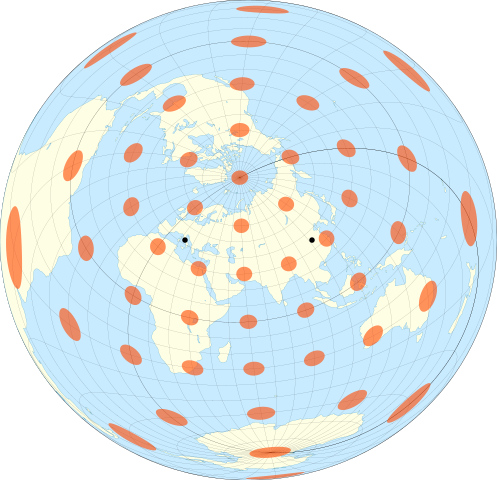
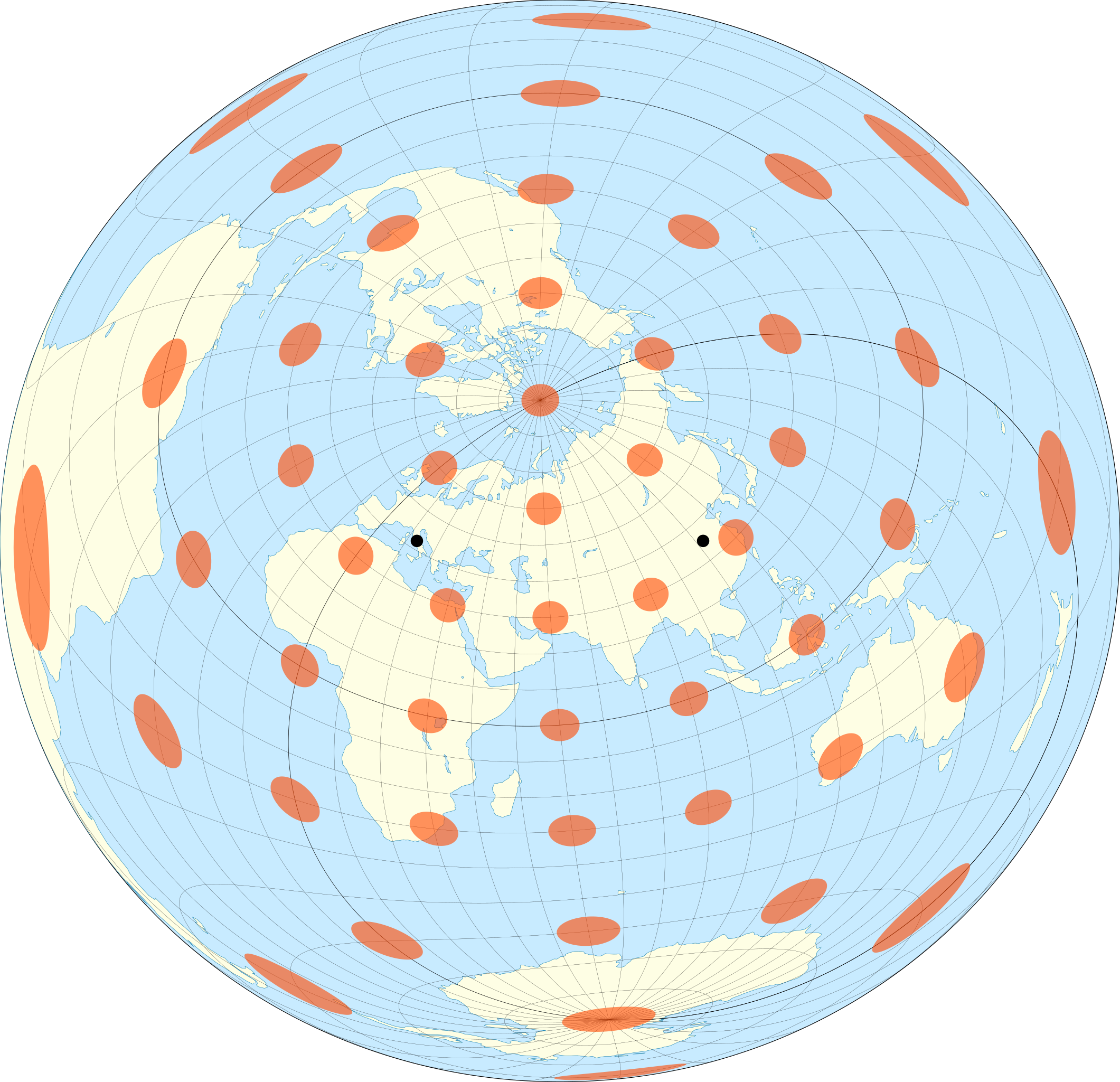
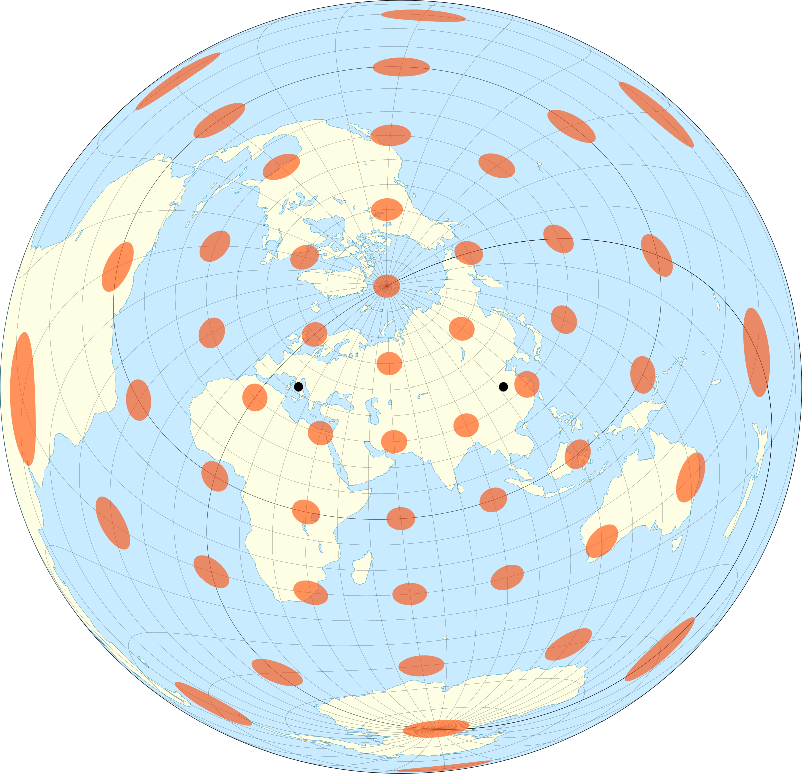
English: The world on a two-point equidistant projection, with 10° graticule and Tissot's indicatrices overlaid. The two points are 41.9°N,12.5°E and 34.7°N,112.4°E. Each red circle is 1,000 km in diameter. Coastline data from www.naturalearthdata.com. Colors inspired by Eric Gaba. Projection generated with my own code, at github.com/jkunimune15/Map-Projections. |
| Date | |
| Source | Own work |
| Author | Justin Kunimune |
Licensing[edit]
I, the copyright holder of this work, hereby publish it under the following license:
| This file is made available under the Creative Commons CC0 1.0 Universal Public Domain Dedication. | |
| The person who associated a work with this deed has dedicated the work to the public domain by waiving all of their rights to the work worldwide under copyright law, including all related and neighboring rights, to the extent allowed by law. You can copy, modify, distribute and perform the work, even for commercial purposes, all without asking permission.
|
File history
Click on a date/time to view the file as it appeared at that time.
| Date/Time | Thumbnail | Dimensions | User | Comment | |
|---|---|---|---|---|---|
| current | 02:12, 16 February 2018 | | 1,600 × 1,545 (616 KB) | Justinkunimune (talk | contribs) | Marked the two points |
| 21:04, 15 February 2018 |  | 1,600 × 1,545 (616 KB) | Justinkunimune (talk | contribs) | User created page with UploadWizard |
You cannot overwrite this file.
File usage on Commons
There are no pages that use this file.
File usage on other wikis
The following other wikis use this file:
- Usage on en.wikipedia.org