File:Tropical Cyclone Trevor (MODIS 2019-03-19).jpg
Jump to navigation
Jump to search

Size of this preview: 714 × 599 pixels. Other resolutions: 286 × 240 pixels | 572 × 480 pixels | 915 × 768 pixels | 1,220 × 1,024 pixels | 2,440 × 2,048 pixels | 7,693 × 6,457 pixels.
Original file (7,693 × 6,457 pixels, file size: 4.2 MB, MIME type: image/jpeg)
Captions
Captions
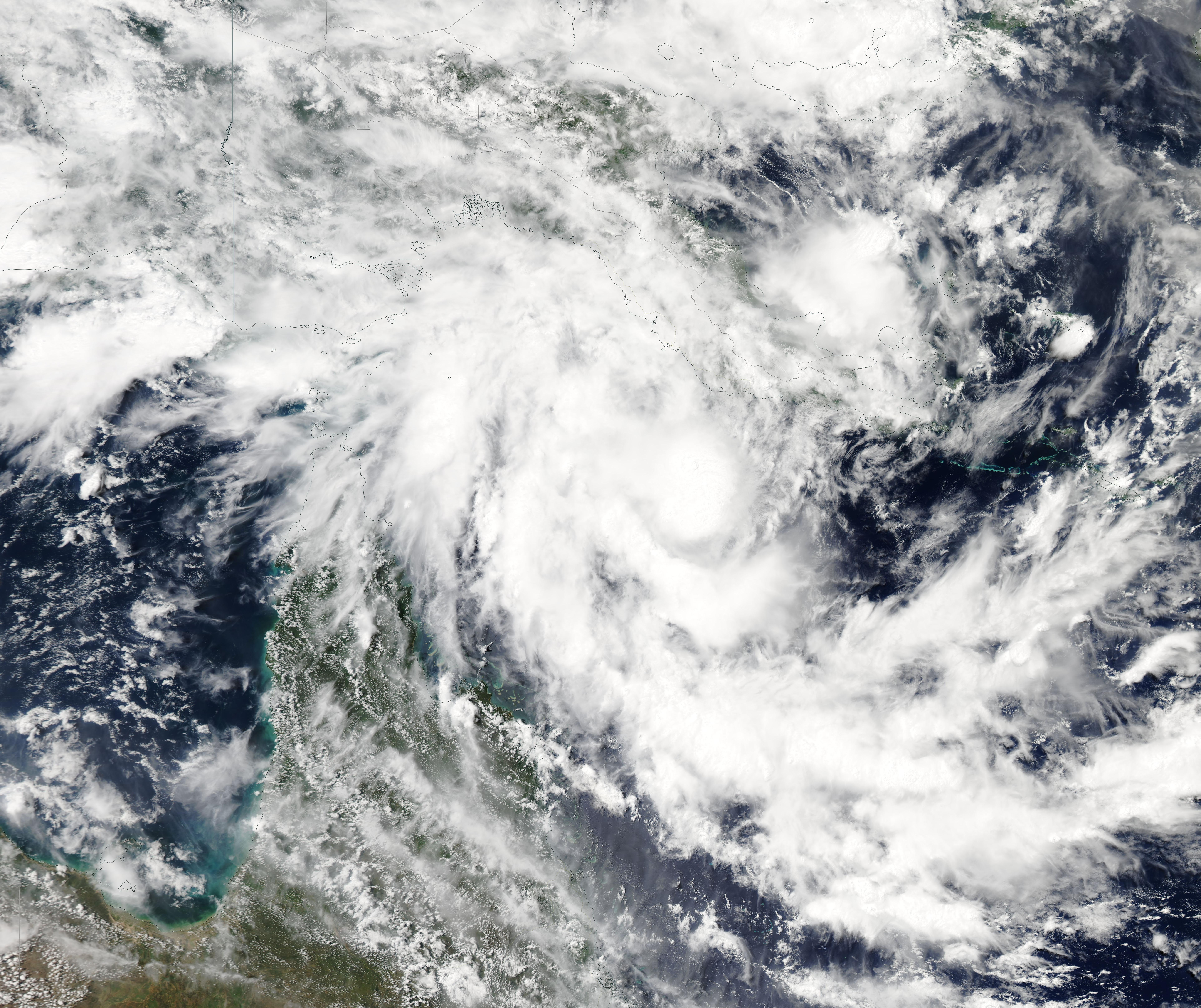
On March 17, 2019, the Moderate Resolution Imaging Spectroradiometer (MODIS) on board NASA’s Aqua satellite acquired a true-color image of Tropical Cyclone Trevor forming in the Coral Sea of the Southwestern Pacific Ocean.
Summary[edit]
.jpg&action=edit§ion=1)
| Description |
English: On March 17, 2019, the Moderate Resolution Imaging Spectroradiometer (MODIS) on board NASA’s Aqua satellite acquired a true-color image of Tropical Cyclone Trevor forming in the Coral Sea of the Southwestern Pacific Ocean. By March 18, the Australian Bureau of Meteorology (BOM) posted warnings on the storm as it approached Queensland. As of the evening of March 18, a tropical cyclone warning is in force from Orford Ness to Cooktown and a tropical cyclone watch is in force from Cape York to Porpuraaw.
The Joint Typhoon Warning Center (JTWC) reported at 5:00 a.m. EDT (0900 UTC) on March 18 that Trevor was located at 12.3 degrees south latitude and 145.0 degrees east longitude. That’s approximately 280 nautical miles north of Cairns, Australia. Trevor was moving west. Maximum sustained winds were near 50 knots (57 mph/84 km/h) and strengthening. JTWC expects that Trevor will strengthen to 70 knots (80.5 /129 km/h), before making landfall in the Cape York Peninsula on Tuesday, March 19. After crossing the peninsula, the storm will emerge into the Gulf of Carpentaria, where it is expected to re-intensify. The forecast track takes Trevor to a second landfall near the Queensland / Northern Territories border on Friday, March 22. |
||
| Date | Taken on 17 March 2019 | ||
| Source |
Tropical Cyclone Trevor (direct link)
|
||
| Author | MODIS Land Rapid Response Team, NASA GSFC |
| This media is a product of the Aqua mission Credit and attribution belongs to the mission team, if not already specified in the "author" row |
Licensing[edit]
.jpg&action=edit§ion=2)
| This file is in the public domain in the United States because it was solely created by NASA. NASA copyright policy states that "NASA material is not protected by copyright unless noted". (See Template:PD-USGov, NASA copyright policy page or JPL Image Use Policy.) | ||
 |
Warnings:
|
File history
Click on a date/time to view the file as it appeared at that time.
| Date/Time | Thumbnail | Dimensions | User | Comment | |
|---|---|---|---|---|---|
| current | 03:27, 17 February 2024 | | 7,693 × 6,457 (4.2 MB) | OptimusPrimeBot (talk | contribs) | #Spacemedia - Upload of http://modis.gsfc.nasa.gov/gallery/images/image03192019_250m.jpg via Commons:Spacemedia |
You cannot overwrite this file.
File usage on Commons
The following page uses this file:
.jpg&oldid=852932602)