File:Triac-Lautrait 16 Pyramide Condé a 2013.jpg
Jump to navigation
Jump to search

Size of this preview: 800 × 493 pixels. Other resolutions: 320 × 197 pixels | 640 × 394 pixels | 1,024 × 631 pixels | 1,280 × 789 pixels | 2,560 × 1,577 pixels | 4,688 × 2,888 pixels.
Original file (4,688 × 2,888 pixels, file size: 13.43 MB, MIME type: image/jpeg)
Captions
Captions
Add a one-line explanation of what this file represents
Summary[edit]
| Description |
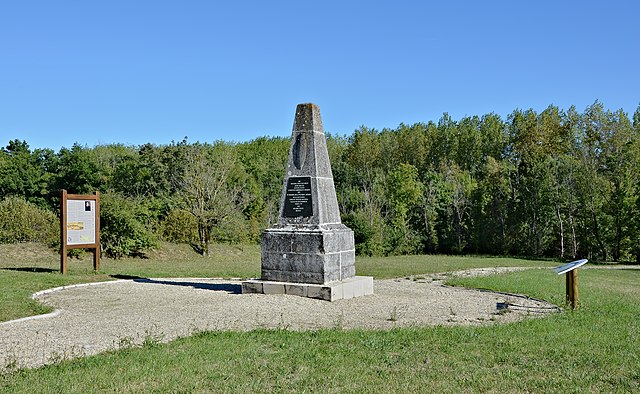
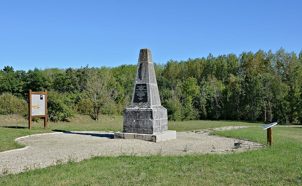
Français : Situation de la Pyramide de Condé (fin XVIIIe-début XIXe) édifiée sur les lieux de la mort de Louis de Bourbon, prince de Condé, lors de la bataille de Jarnac (1569). Triac-Lautrait, Charente, France.
English: Situation of the "Pyramide de Condé" (end of 18th-beginning of 19th century) built on the spot where Louis de Bourbon, Prince de condé, died during the battle of Jarnac (1569). Triac-Lautrait, Charente, France.
|
|
| Date | ||
| Source | Own work | |
| Author | ||
| Attribution (required by the license) | Photo: JLPC / Wikimedia Commons / | |
| Permission (Reusing this file) |
I, the copyright holder of this work, hereby publish it under the following license: This file is licensed under the Creative Commons Attribution-Share Alike 3.0 Unported license.
|
| Camera location | | View this and other nearby images on: OpenStreetMap |
|---|
| Annotations | This image is annotated: View the annotations at Commons |


|
This image has been assessed under the valued image criteria and is considered the most valued image on Commons within the scope: "Pyramide de Condé", Triac-Lautrait, Charente, France, SW view. You can see its nomination here. |
File history
Click on a date/time to view the file as it appeared at that time.
| Date/Time | Thumbnail | Dimensions | User | Comment | |
|---|---|---|---|---|---|
| current | 13:34, 14 October 2013 | | 4,688 × 2,888 (13.43 MB) | JLPC (talk | contribs) |
You cannot overwrite this file.
File usage on Commons
The following 3 pages use this file:
File usage on other wikis
The following other wikis use this file:
- Usage on ceb.wikipedia.org