File:Transmap7.jpg
Jump to navigation
Jump to search

Size of this preview: 539 × 599 pixels. Other resolutions: 216 × 240 pixels | 432 × 480 pixels | 691 × 768 pixels | 921 × 1,024 pixels | 1,888 × 2,098 pixels.
Original file (1,888 × 2,098 pixels, file size: 898 KB, MIME type: image/jpeg)
Captions
Captions
Add a one-line explanation of what this file represents
| Description |
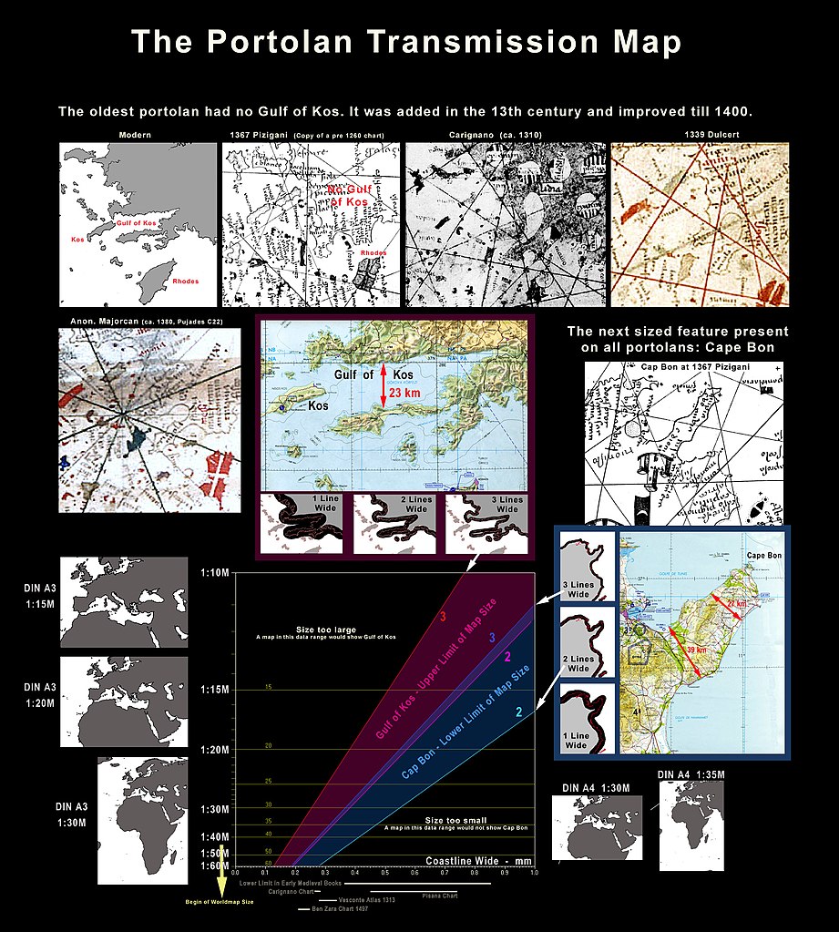
English: Scale range of possible portolan transmission map. Limit by Gulf of Kos absence and Cape Bon presence.
Deutsch: Maßstabs-Bereich einer möglichen Vorlage für Portolankarten des Mittelalters, begrenzt durch das Fehlen des Golf von Kos und das Vorhandensein des Kap Bon. |
|||||||
| Date | ||||||||
| Source |
Own work
|
|||||||
| Author | Portolanero | |||||||
| Permission (Reusing this file) |
This file is licensed under the Creative Commons Attribution 3.0 Unported license.
|
|||||||
| Attribution (required by the license) | http://en.wikipedia.org/wiki/User%3APortolanero / Wikimedia Commons / | |||||||

File history
Click on a date/time to view the file as it appeared at that time.
| Date/Time | Thumbnail | Dimensions | User | Comment | |
|---|---|---|---|---|---|
| current | 07:58, 7 April 2011 | | 1,888 × 2,098 (898 KB) | Portolanero (talk | contribs) | "Transmission" instead of "Source" |
| 10:07, 30 December 2010 |  | 1,852 × 2,179 (892 KB) | Portolanero (talk | contribs) | {{Information |Description={{en|1=Scale range of possible portolan transmission map. Limit by Gulf of Kos absence and Cape Bon presence. }} | Source = {{Own work}} {{PD-old-100}} {{PD-USGov-Military-Air Force}} | Author = Portolanero | Date |
You cannot overwrite this file.
File usage on Commons
There are no pages that use this file.
File usage on other wikis
The following other wikis use this file:
- Usage on ca.wikipedia.org