File:Transcontinental nations.svg
Jump to navigation
Jump to search

Size of this PNG preview of this SVG file: 800 × 411 pixels. Other resolutions: 320 × 164 pixels | 640 × 329 pixels | 1,024 × 526 pixels | 1,280 × 657 pixels | 2,560 × 1,314 pixels | 863 × 443 pixels.
Original file (SVG file, nominally 863 × 443 pixels, file size: 1.6 MB)
Captions
Captions
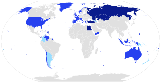
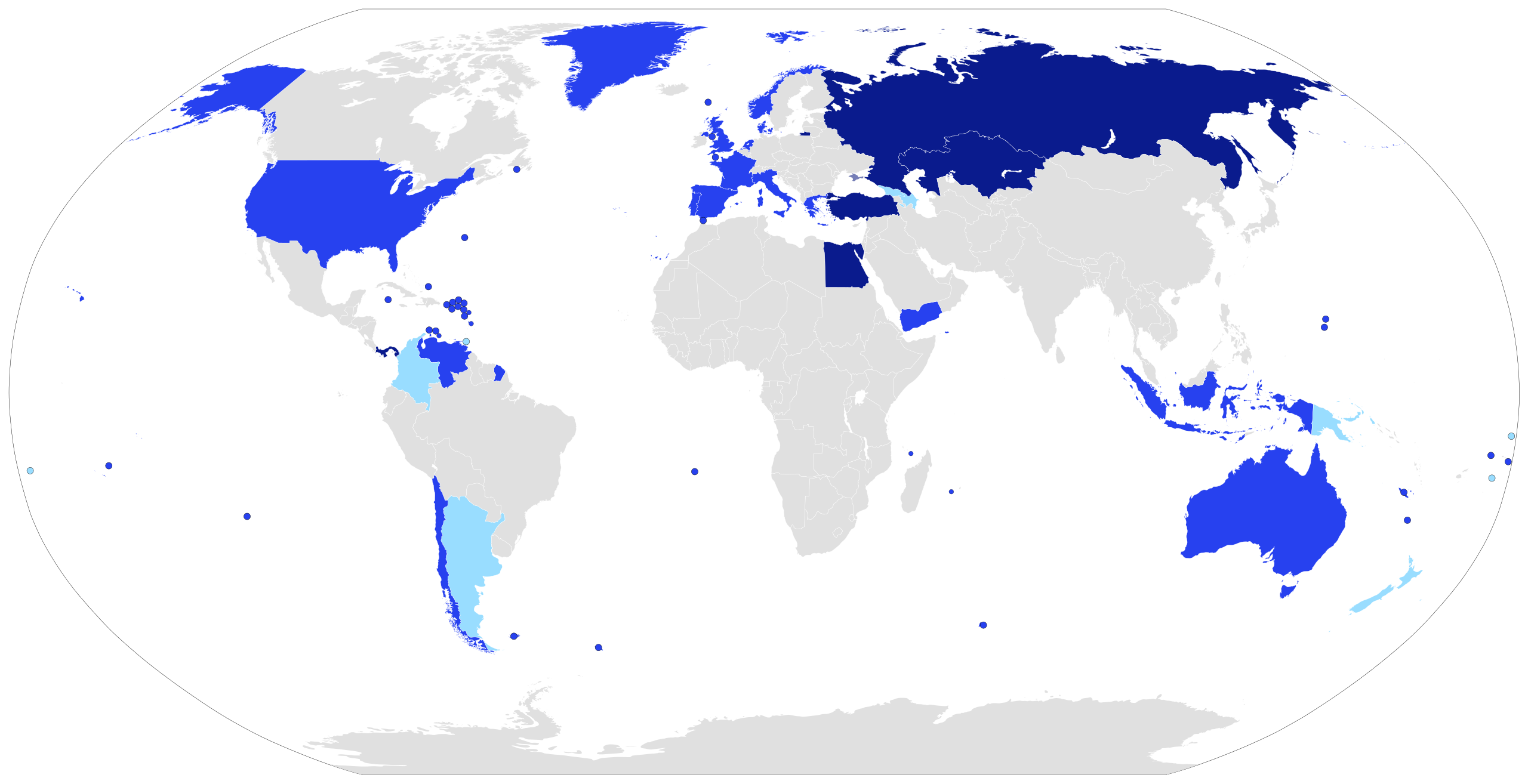
Transcontinental nations
Summary
[edit]
| Description |
English: A map of transcontinental nations.
Contiguous transcontinental countries.
Non-contiguous transcontinental countries.
Considered by some to be transcontinental countries. |
| Date | |
| Source | Own work |
| Author | Jurryaany |
Licensing
[edit]
I, the copyright holder of this work, hereby publish it under the following license:
This file is licensed under the Creative Commons Attribution-Share Alike 4.0 International license.
- You are free:
- to share – to copy, distribute and transmit the work
- to remix – to adapt the work
- Under the following conditions:
- attribution – You must give appropriate credit, provide a link to the license, and indicate if changes were made. You may do so in any reasonable manner, but not in any way that suggests the licensor endorses you or your use.
- share alike – If you remix, transform, or build upon the material, you must distribute your contributions under the same or compatible license as the original.
File history
Click on a date/time to view the file as it appeared at that time.
| Date/Time | Thumbnail | Dimensions | User | Comment | |
|---|---|---|---|---|---|
| current | 10:54, 4 June 2018 | | 863 × 443 (1.6 MB) | Insider (talk | contribs) | -Cyprus, -Armenia, -Japan, -Iceland, -Malayzia, -Philippines fix Georgia (by GSE and Britanica), fix Azerbayjan (by GSE and Britanica), fix Colombia, fix Crimea (NPOV) |
| 01:11, 7 November 2016 |  | 863 × 443 (1.59 MB) | TriadicRelation98 (talk | contribs) | Added Armenia and Cyprus | |
| 07:41, 6 January 2015 |  | 863 × 443 (1.55 MB) | Jurryaany (talk | contribs) | User created page with UploadWizard |
You cannot overwrite this file.
File usage on Commons
There are no pages that use this file.
File usage on other wikis
The following other wikis use this file:
- Usage on af.wikipedia.org
- Usage on ar.wikipedia.org
- Usage on es.wikipedia.org
- Usage on et.wikipedia.org
- Usage on fa.wikipedia.org
- Usage on fi.wikipedia.org
- Usage on fr.wikipedia.org
- Usage on ia.wikipedia.org
- Usage on id.wikipedia.org
- Usage on ja.wikipedia.org
- Usage on kk.wikipedia.org
- Usage on ml.wikipedia.org
- Usage on su.wikipedia.org
- Usage on tr.wikipedia.org
- Usage on ur.wikipedia.org
- Usage on www.wikidata.org