File:Trafalgar Square and area, 1896.png
Jump to navigation
Jump to search

Size of this preview: 696 × 600 pixels. Other resolutions: 279 × 240 pixels | 557 × 480 pixels | 998 × 860 pixels.
Original file (998 × 860 pixels, file size: 2.46 MB, MIME type: image/png)
Captions
Captions
Add a one-line explanation of what this file represents
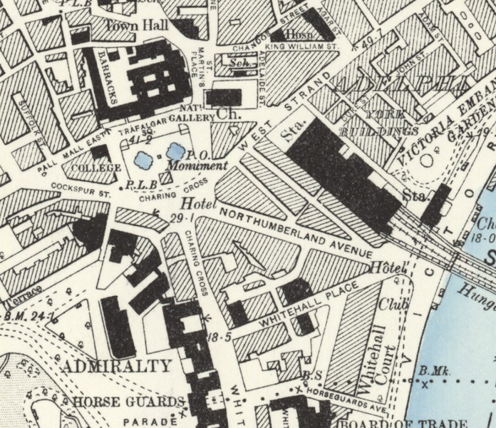
| Description | Area around Trafalgar Square, Charing Cross and Northumberland Avenue on a Victorian Ordnance Survey map. Original map scale: Six inches to One Mile/880 feet to One Inch. |
| Date | |
| Source | Ordnance Survey. London Sheet VII. S.W. 1894-96. Public Domain as published more than 50 years ago. |
| Author | David Cane |
| Permission (Reusing this file) |
This file is licensed under the Creative Commons Attribution 3.0 Unported license. Attribution: David Cane
|
File history
Click on a date/time to view the file as it appeared at that time.
| Date/Time | Thumbnail | Dimensions | User | Comment | |
|---|---|---|---|---|---|
| current | 17:54, 24 January 2016 | | 998 × 860 (2.46 MB) | DavidCane (talk | contribs) | {{Information |Description=Area around Trafalgar Square, Charing Cross and Northumberland Avenue on a Victorian Ordnance Survey map. Original map scale: Six inches to One Mile/880 feet to One Inch. |Source=[[w:Ordnance Survey|Ordn... |
You cannot overwrite this file.
File usage on Commons
The following page uses this file:
File usage on other wikis
The following other wikis use this file:
- Usage on en.wikipedia.org
- Usage on es.wikipedia.org