File:Topographie agen.jpg
Jump to navigation
Jump to search
Size of this preview: 600 × 600 pixels. Other resolutions: 240 × 240 pixels | 480 × 480 pixels | 768 × 768 pixels | 1,024 × 1,024 pixels | 1,280 × 1,280 pixels.
Original file (1,280 × 1,280 pixels, file size: 678 KB, MIME type: image/jpeg)
Captions
Captions
Add a one-line explanation of what this file represents
Summary
[edit]
| Description |
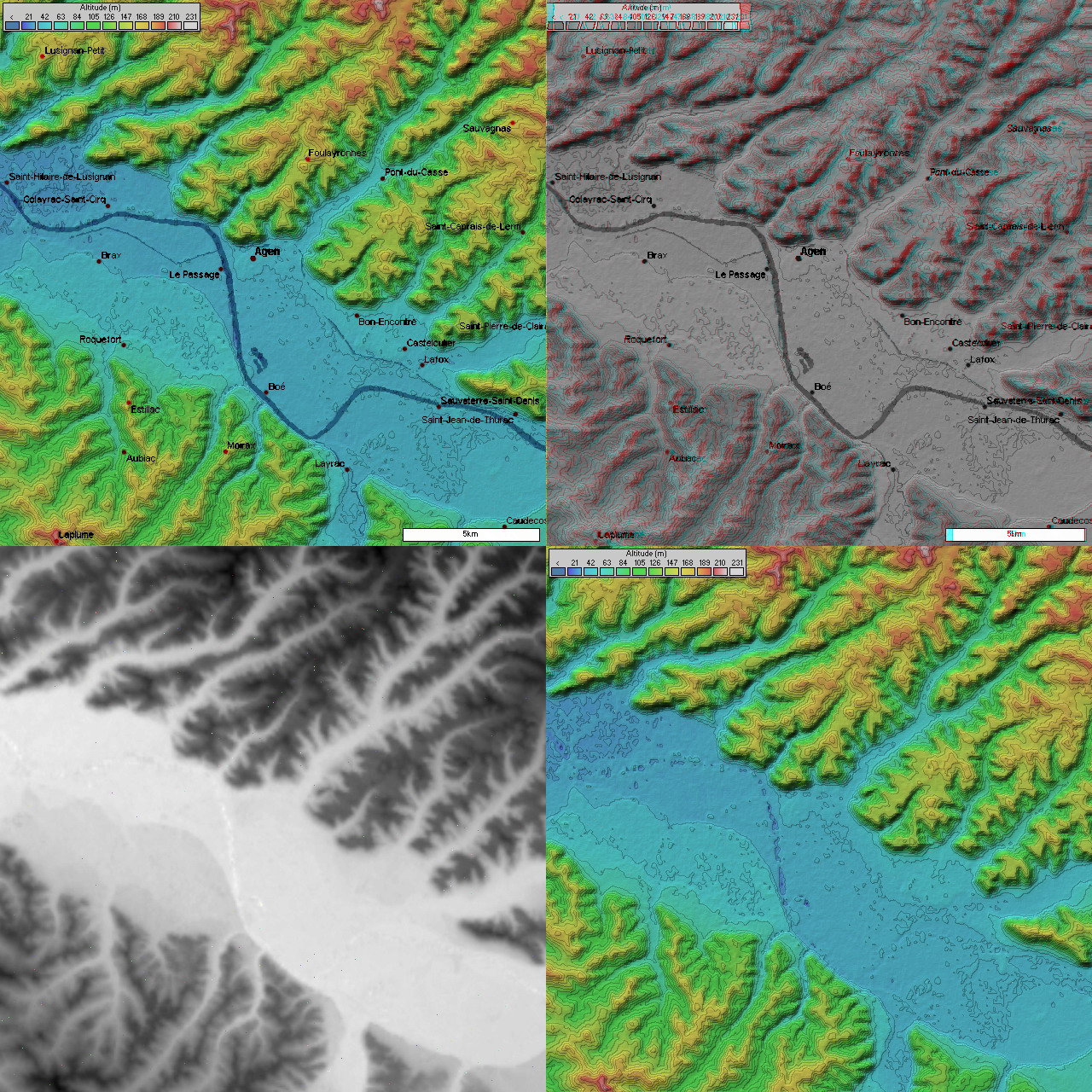
Français : Topographie d'Agen
4 images topographique (20 km de coté) d'Agen prisent par la mission SRTM.
|
| Source | NASA |
| Author | NASA |
Licensing
[edit]
This image uses high-resolution digital topography data from NASA's Shuttle Radar Topography Mission (SRTM) at JPL-Caltech [1]. It is in the public domain in the United States.
|
 | |
Original upload log
[edit]
The original description page was here. All following user names refer to fr.wikipedia.
- 2004-11-16 22:09 NaSH 1280×1280× (694741 bytes) Topographie d'Agen
File history
Click on a date/time to view the file as it appeared at that time.
| Date/Time | Thumbnail | Dimensions | User | Comment | |
|---|---|---|---|---|---|
| current | 22:40, 21 October 2008 | | 1,280 × 1,280 (678 KB) | File Upload Bot (Magnus Manske) (talk | contribs) | {{BotMoveToCommons|fr.wikipedia}} {{Information |Description={{fr|Topographie d'Agen 4 images topographique (20 km de coté) d'Agen prisent par la mission SRTM. * Image topographique + position des villes * image topographique en relief + position de |
You cannot overwrite this file.
File usage on Commons
There are no pages that use this file.
File usage on other wikis
The following other wikis use this file:
- Usage on fr.wikipedia.org
- Usage on zh.wikipedia.org