File:Topographic map of France, 1864 (13422008).jpg
Jump to navigation
Jump to search

Size of this preview: 800 × 563 pixels. Other resolutions: 320 × 225 pixels | 640 × 451 pixels | 1,024 × 721 pixels | 1,280 × 901 pixels | 2,560 × 1,803 pixels | 21,394 × 15,064 pixels.
Original file (21,394 × 15,064 pixels, file size: 54 MB, MIME type: image/jpeg)
Captions
Captions
Add a one-line explanation of what this file represents
Summary[edit]
.jpg&action=edit§ion=1)
| Description |
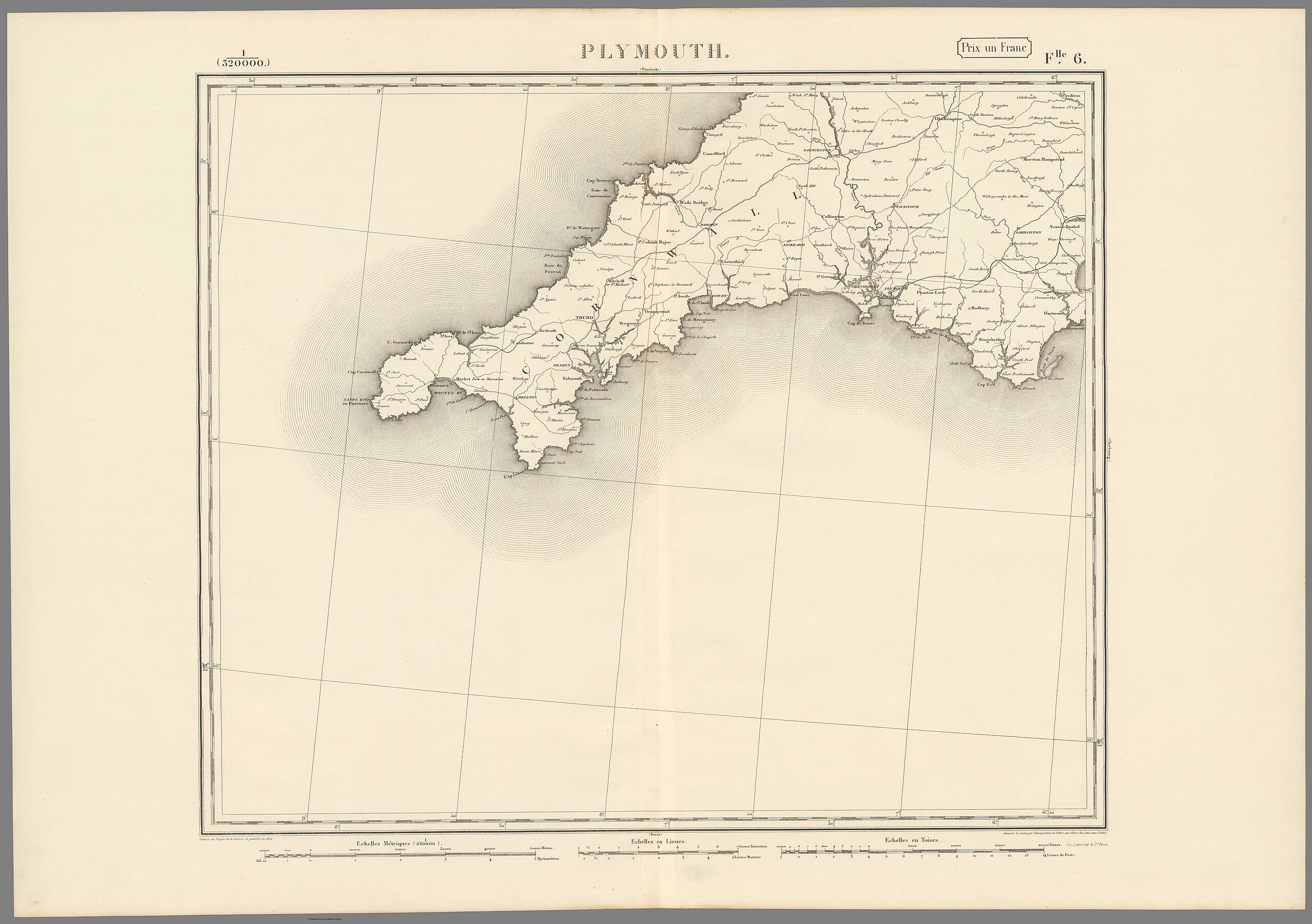
English: Topographic map of France, by the French Army Cartography Department, 1864. Scale 1:320,000. 33 sheets and an assembly chart. Printed by Lemercier & Cie, Paris.
Français : Carte totpographique de la France, par le Dépôt de la Guerre, 1864. échelle 1/320 000. 33 feuilles et un tableau d'assemblage. Imprimerie Lemercier et Cie, Paris. |
| Date | |
| Source | list, main |
| Author | Dépôt de la Guerre |
Licensing[edit]
.jpg&action=edit§ion=2)
|
This is a faithful photographic reproduction of a two-dimensional, public domain work of art. The work of art itself is in the public domain for the following reason:
The official position taken by the Wikimedia Foundation is that "faithful reproductions of two-dimensional public domain works of art are public domain".
This photographic reproduction is therefore also considered to be in the public domain in the United States. In other jurisdictions, re-use of this content may be restricted; see Reuse of PD-Art photographs for details. | ||||
File history
Click on a date/time to view the file as it appeared at that time.
| Date/Time | Thumbnail | Dimensions | User | Comment | |
|---|---|---|---|---|---|
| current | 08:51, 17 August 2023 | | 21,394 × 15,064 (54 MB) | YannBot (talk | contribs) | == {{int:filedesc}} == {{Information |Description={{en|1=''Topographic map of France'', by the French Army Cartography Department, 1864. Scale 1:320,000. 33 sheets and an assembly chart. Printed by Lemercier & Cie, Paris.}} {{fr|1=''Carte totpographique de la France'', par le Dépôt de la Guerre, 1864. échelle 1/320 000. 33 feuilles et un tableau d'assemblage. Imprimerie Lemercier et Cie, Paris.}} |Source=[https://www.davidrumsey.com/luna/servlet/view/search?q=pub_list_no%3d%2213422.000%22 lis... |
You cannot overwrite this file.
File usage on Commons
There are no pages that use this file.
.jpg&oldid=878876696)