File:Topographic map of Budapest.png
Jump to navigation
Jump to search
No higher resolution available.
Topographic_map_of_Budapest.png (600 × 566 pixels, file size: 420 KB, MIME type: image/png)
Captions
Captions
Add a one-line explanation of what this file represents
Summary[edit]
| Description |
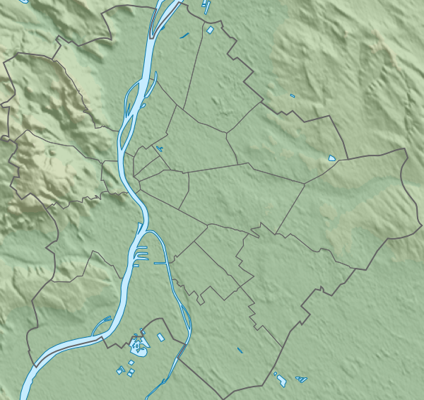
English: Topographic map of Budapest, Hungary with detailed borders. |
| Date | (UTC) |
| Source |
This file was derived from: Budapest districts map.svg:
|
| Author |
|
Licensing[edit]
I, the copyright holder of this work, hereby publish it under the following license:
| I, the copyright holder of this work, release this work into the public domain. This applies worldwide. In some countries this may not be legally possible; if so: I grant anyone the right to use this work for any purpose, without any conditions, unless such conditions are required by law. |
Original upload log[edit]
This image is a derivative work of the following images:
- File:Budapest_districts_map.svg licensed with PD-self
- 2009-07-27T14:06:04Z Droo 600x566 (31885 Bytes) további pontosítás
- 2009-05-14T09:44:47Z Droo 600x566 (32606 Bytes)
- 2008-10-30T14:41:19Z Droo 512x488 (32628 Bytes) pontosítás
- 2008-06-04T16:14:41Z Droo 512x488 (32835 Bytes) Vector map of Budapest, Hungary with detailed borders [[Category:Maps of Budapest]]
- 2007-11-02T16:30:42Z Droo 512x488 (46191 Bytes) {{Information |Description=Vector map of Budapest, Hungary with detailed borders. |Source=self-made |Date=2007-11-02 |Author= [[User:Droo|Droo]] }} [[Category:Maps of Budapest]]
Uploaded with derivativeFX
File history
Click on a date/time to view the file as it appeared at that time.
| Date/Time | Thumbnail | Dimensions | User | Comment | |
|---|---|---|---|---|---|
| current | 23:45, 24 December 2012 | | 600 × 566 (420 KB) | Piroska (talk | contribs) | A bit bigger new image. |
| 23:41, 18 December 2012 |  | 599 × 565 (418 KB) | Piroska (talk | contribs) | == {{int:filedesc}} == {{Information |Description={{en|1=Topographic map of Budapest, Hungary with detailed borders.}} |Source={{Derived from|Budapest_districts_map.svg|display=50}} *Data sources: **Topography: [http://www2.jpl.nasa.gov/srtm NASA Shutt... |
You cannot overwrite this file.
File usage on Commons
There are no pages that use this file.
File usage on other wikis
The following other wikis use this file:
- Usage on en.wikipedia.org
- Usage on eo.wikipedia.org
- Scienca Universitato Loránd Eötvös
- Hungara Scienca Akademio
- Universitato Corvinus de Budapeŝto
- Placo de Herooj
- Hungara Nacia Galerio
- Insulo Margareta
- Telefonia Muzeo
- Belarta Muzeo (Budapeŝto)
- Muzeo pri Teksaĵ- kaj Vestaĵindustrio en Budapeŝto
- Hungara Nacia Muzeo
- Festivalo Sziget
- Placo Kossuth Lajos
- Aquincum
- Kastelo Vajdahunyad
- Monto Vár
- Parko Memento
- Tutlanda Biblioteko Széchényi
- Palaco de Artoj
- Placo Lujza Blaha
- Bestoĝardeno kaj Botanika ĝardeno (Budapeŝto)
- Placo Kálvin
- Placo Széchenyi (Budapeŝto)
- Hungara Televido
- Ŝablono:Situo sur mapo Hungario Budapeŝto
- Ŝablono:Situo sur mapo Hungario Budapeŝto/dokumentado
- Avenuo Andrássy
- Placo Mari Jászai
- Literatura Muzeo Petőfi
- Orientazia Arta Muzeo (Budapeŝto)
- Domo de Paciĝo
- Hungara Muzeo pri Metia Arto
- Internacia Federacio de Ĵudo
- Universitato Semmelweis
- Teknika kaj Ekonomia Universitato de Budapeŝto
- Katolika Universitato Péter Pázmány
- Universitato Andrássy
- Palaco Festetics
- Palaco Sándor (Budapeŝto)
- Arthalo Budapeŝto
- Palaco Károlyi
- Reĝa Palaco (Budapeŝto)
- Palaco Vigadó
- Palaco Gresham
- Palaco Wenckheim
View more global usage of this file.