File:Tombstone Territorial Park banner Tombstone mountain.jpg
Original file (6,000 × 2,001 pixels, file size: 3.71 MB, MIME type: image/jpeg)
Captions
Summary[edit]
DescriptionTombstone Territorial Park banner Tombstone mountain.jpg |
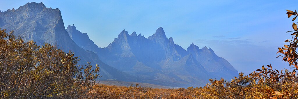
Français : Mont Tombstone à l'automne dans le parc territorial de Tombstone au Yukon lors d'une journée enfumée causée par des feux de forêt à proximité
English: Tombstone Mountain in fall in Tombstone Territorial Park in Yukon during a smoky day caused by nearby wildfires
English: Tombstone Mountain in fall in Tombstone Territorial Park, Yukon |
|||
Date | ||||
Source | Own work | |||
Author | J-A Béland | |||
Other versions |
|
Licensing[edit]
- You are free:
- to share – to copy, distribute and transmit the work
- to remix – to adapt the work
- Under the following conditions:
- attribution – You must give appropriate credit, provide a link to the license, and indicate if changes were made. You may do so in any reasonable manner, but not in any way that suggests the licensor endorses you or your use.
- share alike – If you remix, transform, or build upon the material, you must distribute your contributions under the same or compatible license as the original.
This image was uploaded as part of Wiki Loves Earth 2020.
aragonés ∙ العربية ∙ asturianu ∙ azərbaycanca ∙ беларуская (тарашкевіца) ∙ български ∙ বাংলা ∙ brezhoneg ∙ català ∙ čeština ∙ Cymraeg ∙ Deutsch ∙ Ελληνικά ∙ English ∙ español ∙ eesti ∙ euskara ∙ فارسی ∙ français ∙ galego ∙ עברית ∙ hrvatski ∙ հայերեն ∙ Bahasa Indonesia ∙ italiano ∙ 日本語 ∙ ქართული ∙ 한국어 ∙ latviešu ∙ македонски ∙ മലയാളം ∙ मराठी ∙ Bahasa Melayu ∙ norsk bokmål ∙ नेपाली ∙ Nederlands ∙ norsk ∙ polski ∙ português ∙ português do Brasil ∙ română ∙ русский ∙ sicilianu ∙ shqip ∙ slovenščina ∙ српски / srpski ∙ svenska ∙ ไทย ∙ Türkçe ∙ українська ∙ اردو ∙ 简体中文 ∙ 繁體中文 ∙ +/− |
File history
Click on a date/time to view the file as it appeared at that time.
Date/Time | Thumbnail | Dimensions | User | Comment | |
---|---|---|---|---|---|
current | 23:00, 2 June 2023 | 6,000 × 2,001 (3.71 MB) | AlasdairW (talk | contribs) | File:Tombstone mountain.jpg cropped 50 % vertically using CropTool with precise mode. |
You cannot overwrite this file.
File usage on Commons
The following page uses this file:
File usage on other wikis
The following other wikis use this file:
- Usage on en.wikipedia.org
- Usage on en.wikivoyage.org
Metadata
This file contains additional information such as Exif metadata which may have been added by the digital camera, scanner, or software program used to create or digitize it. If the file has been modified from its original state, some details such as the timestamp may not fully reflect those of the original file. The timestamp is only as accurate as the clock in the camera, and it may be completely wrong.
Camera manufacturer | NIKON CORPORATION |
---|---|
Camera model | NIKON D5200 |
Exposure time | 1/500 sec (0.002) |
F-number | f/10 |
ISO speed rating | 250 |
Date and time of data generation | 15:01, 11 September 2019 |
Lens focal length | 22 mm |
JPEG file comment | |
Orientation | Normal |
Horizontal resolution | 300 dpi |
Vertical resolution | 300 dpi |
Software used | GIMP 2.10.20 |
File change date and time | 16:37, 9 July 2020 |
Y and C positioning | Co-sited |
Exposure Program | Manual |
Exif version | 2.3 |
Date and time of digitizing | 15:01, 11 September 2019 |
Meaning of each component |
|
Image compression mode | 2 |
APEX exposure bias | 0 |
Maximum land aperture | 4 APEX (f/4) |
Metering mode | Pattern |
Light source | Unknown |
Flash | Flash did not fire |
DateTime subseconds | 20 |
DateTimeOriginal subseconds | 20 |
DateTimeDigitized subseconds | 20 |
Supported Flashpix version | 1 |
Color space | sRGB |
Sensing method | One-chip color area sensor |
File source | Digital still camera |
Scene type | A directly photographed image |
Custom image processing | Normal process |
Exposure mode | Manual exposure |
White balance | Auto white balance |
Digital zoom ratio | 1 |
Focal length in 35 mm film | 22 mm |
Scene capture type | Standard |
Scene control | None |
Contrast | Normal |
Saturation | Normal |
Sharpness | Normal |
Subject distance range | Unknown |
GPS tag version | 0.0.3.2 |
Structured data
Items portrayed in this file
depicts
11 September 2019
0.002 second
10
22 millimetre
250
image/jpeg
- Protected areas of Canada with known IDs
- Extracted images
- CC-BY-SA-4.0
- Self-published work
- Images from Wiki Loves Earth 2020
- Images from Wiki Loves Earth 2020 in Canada
- Images from Wiki Loves Earth missing SDC depicts
- Images from Wiki Loves Earth missing SDC location of creation
- Uploaded via Campaign:wle-ca