File:Togoland-No-Akosombo-Dam-plain.svg

Original file (SVG file, nominally 730 × 1,201 pixels, file size: 159 KB)
Captions
Captions
Summary[edit]
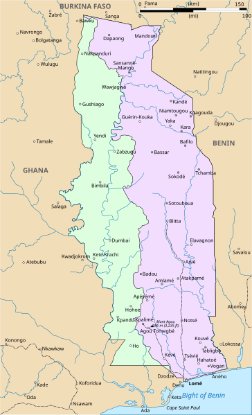
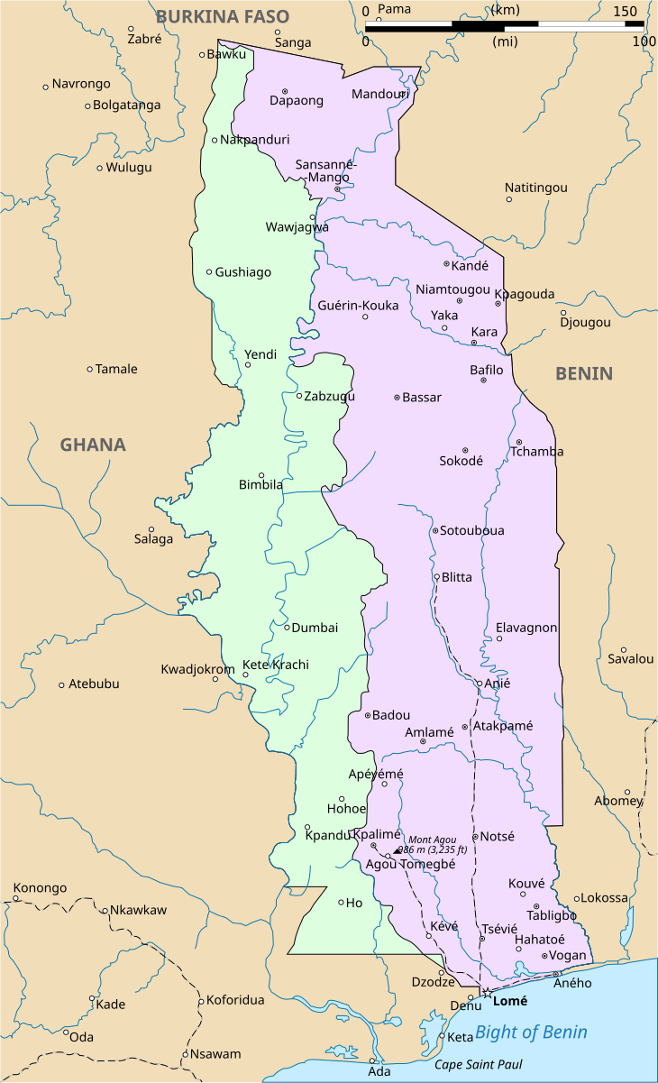
| Description | Map of Togoland showing delimitation between French and British Togoland. Version without the Akosombo Dam |
| Date | |
| Source | File:Togo Deutsches Koloniallexikon, Verlag von Quelle & Meyer Leipzig.jpg+File:Togo political map 2007, CIA.jpg |
| Author | User:Nostrifikator |
| Other versions |
|


This file is translated using SVG <switch> elements. All translations are stored in the same file! Learn more.
For most Wikipedia projects, you can embed the file normally (without a To translate the text into your language, you can use the SVG Translate tool. Alternatively, you can download the file to your computer, add your translations using whatever software you're familiar with, and re-upload it with the same name. You will find help in Graphics Lab if you're not sure how to do this. |
Licensing[edit]
| I, the copyright holder of this work, release this work into the public domain. This applies worldwide. In some countries this may not be legally possible; if so: I grant anyone the right to use this work for any purpose, without any conditions, unless such conditions are required by law. |
File history
Click on a date/time to view the file as it appeared at that time.
| Date/Time | Thumbnail | Dimensions | User | Comment | |
|---|---|---|---|---|---|
| current | 09:39, 8 March 2022 | | 730 × 1,201 (159 KB) | Nostrifikator (talk | contribs) | == {{int:filedesc}} == {{Information |Description=Map of Togoland showing delimitation between French and British Togoland. Version without the Akosombo Dam |Source=File:Togo Deutsches Koloniallexikon, Verlag von Quelle & Meyer Leipzig.jpg+File:Togo political map 2007, CIA.jpg |Date=2022-03-08 |Author=User:Nostrifikator |Permission= |other_versions=File:Togoland.png }} {{Created with Inkscape}} {{Translate|switch=yes}} == {{int:license-header}} == {{PD-self}} [[Category:M... |
You cannot overwrite this file.
File usage on Commons
The following page uses this file: