File:Togo Präfekturen 2019.svg
Jump to navigation
Jump to search

Size of this PNG preview of this SVG file: 391 × 600 pixels. Other resolutions: 156 × 240 pixels | 313 × 480 pixels | 500 × 768 pixels | 667 × 1,024 pixels | 1,335 × 2,048 pixels | 736 × 1,129 pixels.
Original file (SVG file, nominally 736 × 1,129 pixels, file size: 227 KB)
Captions
Captions
Add a one-line explanation of what this file represents
Summary
[edit]| Description |
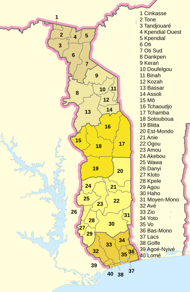
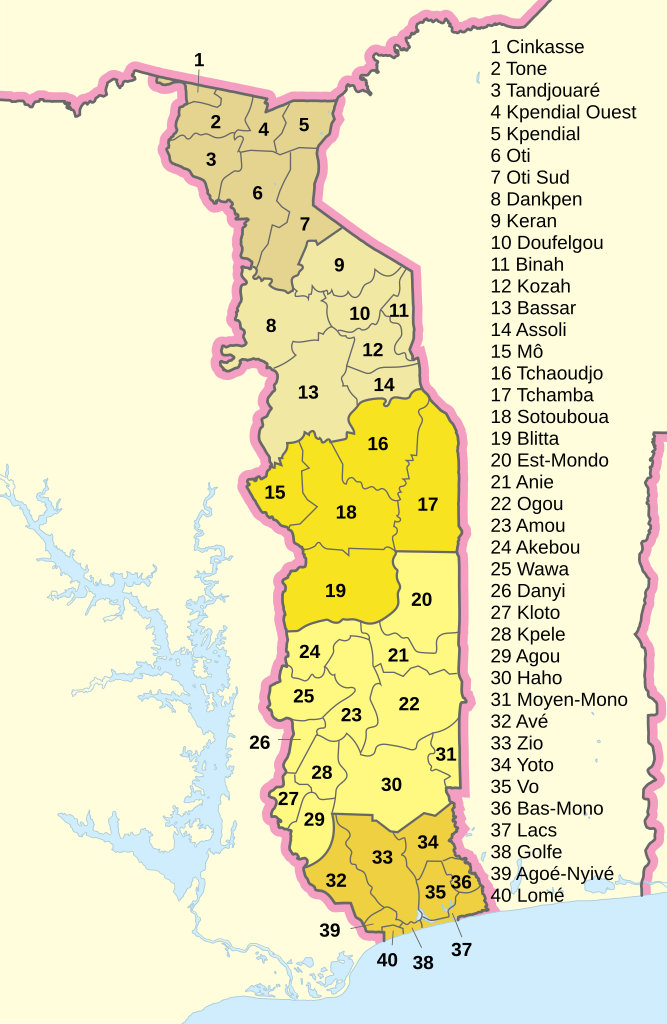
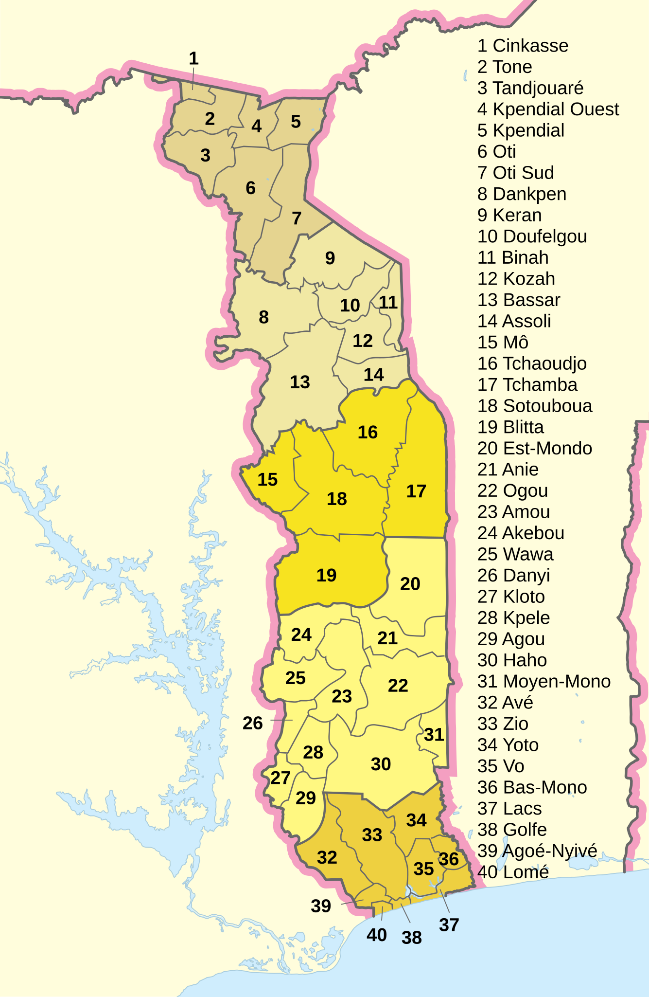
Deutsch: Präfekturen von Togo (2019).
English: prefectures of Togo in 2019.
Français : Préfectures du Togo en 2019. |
||
| Date | |||
| Source |
Derived from various gouvernment sources: Note: this map is not very accurate because of lack of suitable templates. |
||
| Author | Furfur | ||
| Permission (Reusing this file) |
I, the copyright holder of this work, hereby publish it under the following licenses:
This file is licensed under the Creative Commons Attribution-Share Alike 4.0 International license.
You may select the license of your choice. |
||
| SVG development | This map was created with Adobe Illustrator. |

File history
Click on a date/time to view the file as it appeared at that time.
| Date/Time | Thumbnail | Dimensions | User | Comment | |
|---|---|---|---|---|---|
| current | 16:51, 30 April 2020 | | 736 × 1,129 (227 KB) | Furfur (talk | contribs) | Kosmetik |
| 16:41, 30 April 2020 |  | 736 × 1,129 (226 KB) | Furfur (talk | contribs) | + weitere Präfekturen | |
| 10:30, 30 April 2020 |  | 736 × 1,129 (234 KB) | Furfur (talk | contribs) | Kosmetik | |
| 09:56, 30 April 2020 |  | 736 × 1,129 (238 KB) | Furfur (talk | contribs) | == {{int:filedesc}} == {{Information |Description={{User:Medium69/Traduction}} {{de|1=Präfekturen von Togo (2019).}} {{en|1=prefectures of Togo in 2019.}} {{fr|1=Préfectures du Togo en 2019.}} |Source=Derived from various gouvernment sources: * [https://www.afro.who.int/sites/default/files/2017-10/Principaux%20indicateurs%20de%20sant%C3%A9%202016.pdf Annuaire statistiques du Togo] * [https://territoire.gouv.tg/node/324 Quatre nouvelles préfectures au Togo] '''Note:''' this map is not very ac... |
You cannot overwrite this file.
File usage on Commons
The following page uses this file:
File usage on other wikis
The following other wikis use this file:
- Usage on de.wikipedia.org
- Usage on www.wikidata.org