File:Timor map 1820 (02).jpg
Jump to navigation
Jump to search
Size of this preview: 776 × 600 pixels. Other resolutions: 311 × 240 pixels | 621 × 480 pixels | 993 × 768 pixels | 1,318 × 1,019 pixels.
Original file (1,318 × 1,019 pixels, file size: 120 KB, MIME type: image/jpeg)
Captions
Captions
Add a one-line explanation of what this file represents
Summary
[edit]| Description |
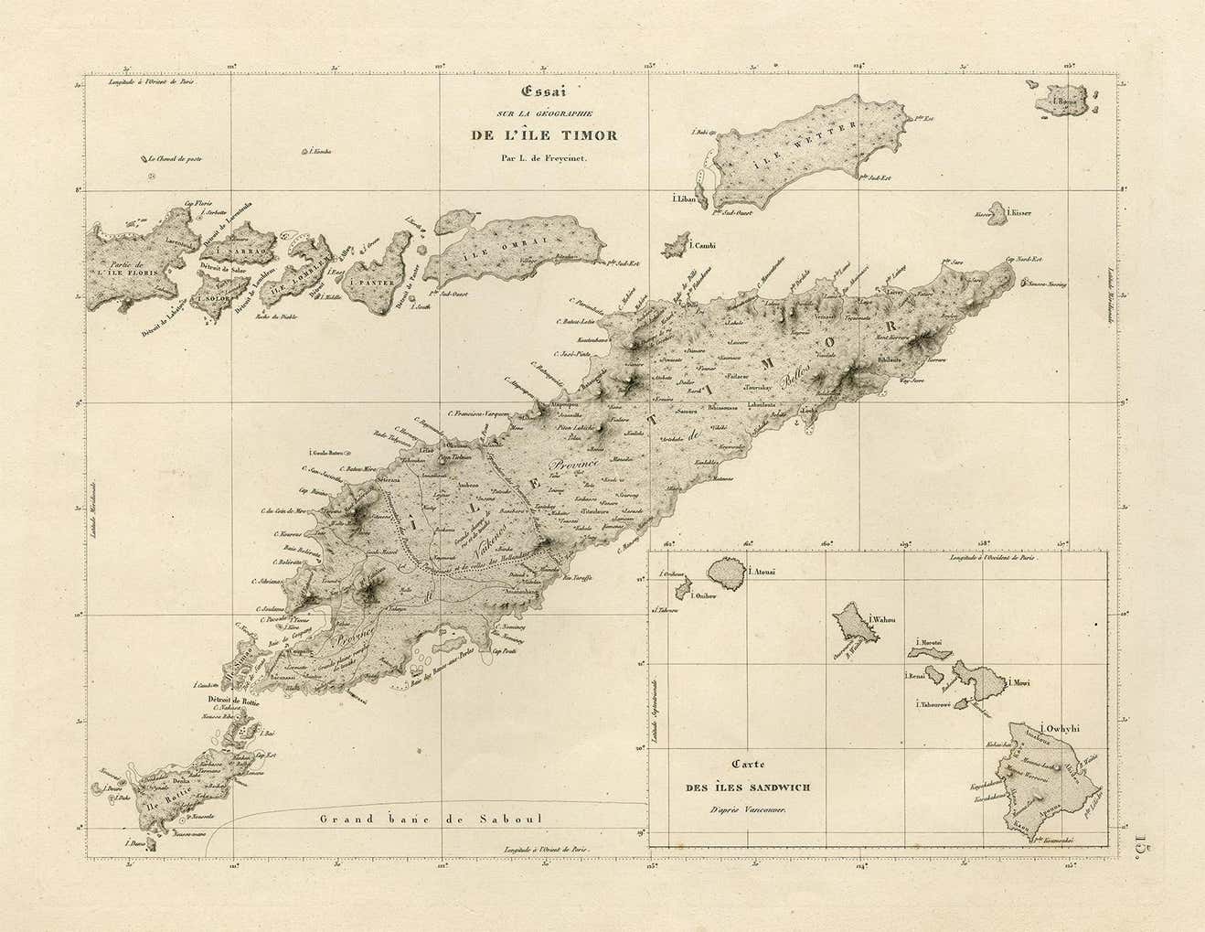
English: A different, lower resolution, version of "Timor map 1820", in particular without the "Bibliothèque nationale" stamp near the middle of the image; includes an inset map of Hawaii |
||||||||||||||||||||
| Date | |||||||||||||||||||||
| Source | 1stDibs | ||||||||||||||||||||
| Author |
|
||||||||||||||||||||
| Other versions |
 |
||||||||||||||||||||

.jpg&action=edit§ion=1)
Licensing
[edit].jpg&action=edit§ion=2)
|
This work is in the public domain in its country of origin and other countries and areas where the copyright term is the author's life plus 70 years or fewer. This work is in the public domain in the United States because it was published (or registered with the U.S. Copyright Office) before January 1, 1929. | |
| This file has been identified as being free of known restrictions under copyright law, including all related and neighboring rights. | |
File history
Click on a date/time to view the file as it appeared at that time.
| Date/Time | Thumbnail | Dimensions | User | Comment | |
|---|---|---|---|---|---|
| current | 04:06, 28 January 2022 | | 1,318 × 1,019 (120 KB) | Bahnfrend (talk | contribs) | Uploaded a work by {{Creator:Louis de Freycinet}} from [https://www.1stdibs.com/furniture/more-furniture-collectibles/collectibles-curiosities/maps/rare-antique-map-timor-nearby-islands-plus-inset-of-hawaii-1825/id-f_26741852/ 1stDibs] with UploadWizard |
You cannot overwrite this file.
File usage on Commons
The following 4 pages use this file:
.jpg&oldid=819807699)