File:Thuringia Merkers Mines asv2020-07 img10.jpg
Jump to navigation
Jump to search

Size of this preview: 800 × 534 pixels. Other resolutions: 320 × 213 pixels | 640 × 427 pixels | 1,024 × 683 pixels | 1,280 × 854 pixels | 2,560 × 1,707 pixels | 6,521 × 4,349 pixels.
Original file (6,521 × 4,349 pixels, file size: 14.32 MB, MIME type: image/jpeg)
Captions
Captions
Add a one-line explanation of what this file represents
Summary[edit]
| Description |
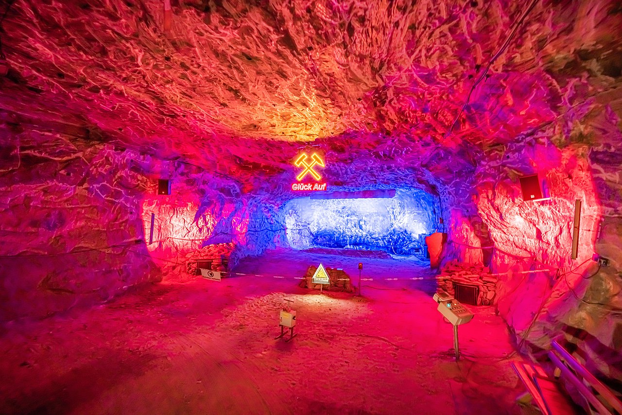
Deutsch: Das Salzbergwerk, auch bekannt als Erlebnisbergwerk, in Merkers (Thüringen, Deutschland). Das Bild zeigt den Raum, in dem für Touristen simulierte Sprengungen durchgeführt werden, in ca. 700-800m Teufe.
English: The salt mines' complex, which is being used for tourist excursions too, in Merkers (Thuringia, Germany). The picture shows the room for simulated detonations, in nearly 700-800m underground depth.
Русский: Комплекс соляных шахт, использующийся также в качестве туристического объекта, в населённом пункте Меркерс (Тюрингия, Германия). На фотографии – помещение, в котором для посетителей проводятся имитации взрывания породы, на глубине около 700-800м. |
| Date | |
| Source | Own work |
| Author | A.Savin |
| Permission (Reusing this file) |
.svg) Just attribute the author: «A.Savin, Wikipedia»; if you have questions — Telegram, or e-mail to wikiphotospace@gmail.com..svg) Просто укажите в качестве автора: «А.Савин, Википедия»; если есть вопрос — телеграм, или эл.почта на wikiphotospace@gmail.com. Kennzeichnen Sie einfach als Autor: «A.Savin, Wikipedia»; falls Sie Fragen haben — Telegram, oder E-Mail an wikiphotospace@gmail.com.
Thank you. |
| Camera location | | View this and other nearby images on: OpenStreetMap |
|---|
Licensing[edit]
| Copyleft: This work of art is free; you can redistribute it and/or modify it according to terms of the Free Art License. You will find a specimen of this license on the Copyleft Attitude site as well as on other sites. |
File history
Click on a date/time to view the file as it appeared at that time.
| Date/Time | Thumbnail | Dimensions | User | Comment | |
|---|---|---|---|---|---|
| current | 03:54, 11 December 2020 | | 6,521 × 4,349 (14.32 MB) | A.Savin (talk | contribs) | {{User:A.Savin/F|L=0 |Description= {{de|Das Salzbergwerk, auch bekannt als Erlebnisbergwerk, in Merkers (Thüringen, Deutschland). Das Bild zeigt den Raum, in dem für Touristen simulierte Sprengungen durchgeführt werden, in ca. 700-800m Teufe.}} {{en|The salt mines' complex, which is being used for tourist excursions too, in Merkers (Thuringia, Germany). The picture shows the room for simulated detonations, in nearly 700-800m underground depth.}} {{ru|Комплекс соляных шахт, использующийся такж... |
You cannot overwrite this file.
File usage on Commons
There are no pages that use this file.