File:The view from Scrabo (2) - geograph.org.uk - 1295485.jpg
Jump to navigation
Jump to search
No higher resolution available.
The_view_from_Scrabo_(2)_-_geograph.org.uk_-_1295485.jpg (640 × 401 pixels, file size: 88 KB, MIME type: image/jpeg)
Captions
Captions
Add a one-line explanation of what this file represents
Summary
[edit]_-_geograph.org.uk_-_1295485.jpg&action=edit§ion=1)
| Description |
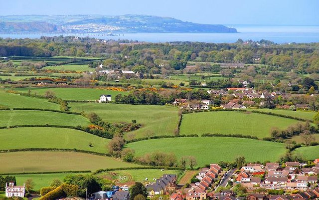
English: The view from Scrabo (2). See 1295419. The view to the north. Part of Newtownards can be seen at the bottom. Above that are the drumlins of north Down. Beyond them are Clandeboye Wood 793296 and the Clandeboye estate. The expanse of water is Belfast Lough with the Co Antrim coast at the top - Blackhead lighthouse 173761 is visible in the original on the headland at top right. Continue to 1295552. |
| Date | |
| Source | From geograph.org.uk |
| Author | Albert Bridge |
| Attribution (required by the license) | Albert Bridge / The view from Scrabo (2) / |
_-_geograph.org.uk_-_1295419.jpg)
_-_geograph.org.uk_-_1295552.jpg)
| Camera location | | View this and other nearby images on: OpenStreetMap |
|---|
_-_geograph.org.uk_-_1295485.jpg¶ms=054.580380_N_-005.714900_E_globe:Earth_type:camera_source:geograph-irishgrid(J47797263)_heading:0.00&language=en)
| Object location | | View this and other nearby images on: OpenStreetMap |
|---|
_-_geograph.org.uk_-_1295485.jpg¶ms=054.626900_N_-005.713900_E_globe:Earth_class:object_type:object_source:geograph-irishgrid(J47697781)_heading:0.00&language=en)
Licensing
[edit]_-_geograph.org.uk_-_1295485.jpg&action=edit§ion=2)

|
This image was taken from the Geograph project collection. See this photograph's page on the Geograph website for the photographer's contact details. The copyright on this image is owned by Albert Bridge and is licensed for reuse under the Creative Commons Attribution-ShareAlike 2.0 license.
|
This file is licensed under the Creative Commons Attribution-Share Alike 2.0 Generic license.
Attribution: Albert Bridge
- You are free:
- to share – to copy, distribute and transmit the work
- to remix – to adapt the work
- Under the following conditions:
- attribution – You must give appropriate credit, provide a link to the license, and indicate if changes were made. You may do so in any reasonable manner, but not in any way that suggests the licensor endorses you or your use.
- share alike – If you remix, transform, or build upon the material, you must distribute your contributions under the same or compatible license as the original.
File history
Click on a date/time to view the file as it appeared at that time.
| Date/Time | Thumbnail | Dimensions | User | Comment | |
|---|---|---|---|---|---|
| current | 11:14, 27 February 2011 | | 640 × 401 (88 KB) | GeographBot (talk | contribs) | == {{int:filedesc}} == {{Information |description={{en|1=The view from Scrabo (2) See 1295419. The view to the north. Part of Newtownards can be seen at the bottom. Above that are the drumlins of north Down. Beyond them are Clandeboye Wood [[7932 |
You cannot overwrite this file.
File usage on Commons
There are no pages that use this file.
_-_geograph.org.uk_-_1295485.jpg&oldid=716311097)