File:The Stockholm Archipelago.png
Jump to navigation
Jump to search
Size of this preview: 270 × 599 pixels. Other resolutions: 108 × 240 pixels | 216 × 480 pixels | 346 × 768 pixels | 461 × 1,024 pixels | 1,816 × 4,032 pixels.
Original file (1,816 × 4,032 pixels, file size: 7.41 MB, MIME type: image/png)
Captions
Captions
Add a one-line explanation of what this file represents
Summary[edit]
| Description |
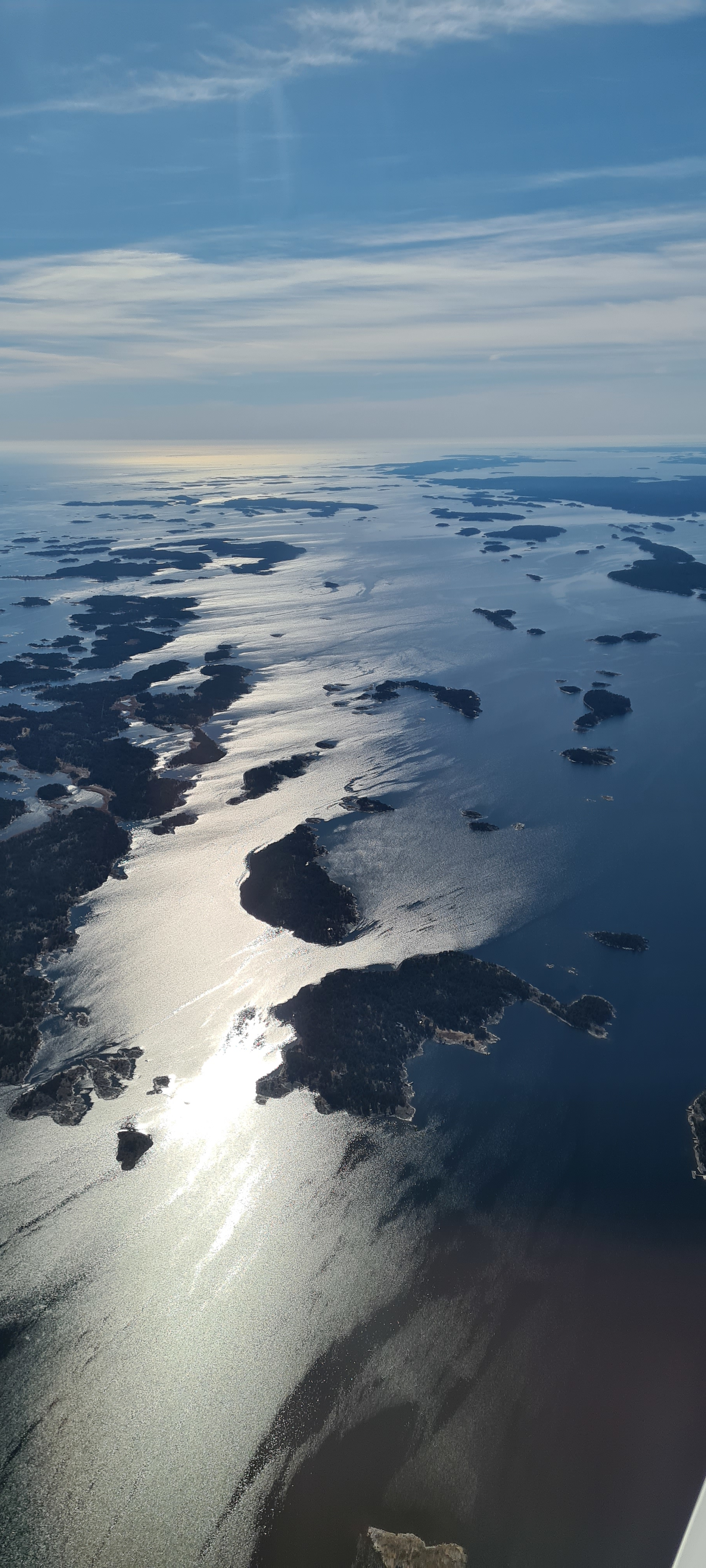
English: The photo was taken though the window of a Piper PA-28-181 Archer III in Easter 2023. Just south of Nämdö and Orrön looking southwest. The islands featured in the center (front to back) are Hemskär then Högholmen. At the very center of the image is Gymmerholmen, with Jungfruskärs naturreservat to its left and Hästholmen the right. The background features Villinge Boskapsö to the left and Mörtö-Bunsö to the right.
Svenska: Bilden är tagen genom fönstret på en Piper PA-28-181 Archer III påsken 2023. Strax söder om Nämdö och Orrön i sydvästlig blick. Stora öar i centrum (framifrån och bak) är Hemskär sedan Högholmen. I mitten av bilden ligger Gymmerholmen, med Jungfruskärs naturreservat till vänster och Hästholmen till höger. Bakgrunden syns till Villinge Boskapsö till vänster och Mörtö-Bunsö till höger.
|
||||||||
| Date | |||||||||
| Source | Own work | ||||||||
| Author | David Cox |
| Camera location | | View this and other nearby images on: OpenStreetMap |
|---|
Licensing[edit]
I, the copyright holder of this work, hereby publish it under the following license:
This file is licensed under the Creative Commons Attribution-Share Alike 4.0 International license.
- You are free:
- to share – to copy, distribute and transmit the work
- to remix – to adapt the work
- Under the following conditions:
- attribution – You must give appropriate credit, provide a link to the license, and indicate if changes were made. You may do so in any reasonable manner, but not in any way that suggests the licensor endorses you or your use.
- share alike – If you remix, transform, or build upon the material, you must distribute your contributions under the same or compatible license as the original.
This image was uploaded as part of Wiki Loves Earth 2023.
|
 |
File history
Click on a date/time to view the file as it appeared at that time.
| Date/Time | Thumbnail | Dimensions | User | Comment | |
|---|---|---|---|---|---|
| current | 20:21, 3 May 2023 | | 1,816 × 4,032 (7.41 MB) | Spirail (talk | contribs) | Uploaded own work with UploadWizard |
You cannot overwrite this file.
File usage on Commons
The following page uses this file:
File usage on other wikis
The following other wikis use this file:
- Usage on sv.wikipedia.org