File:The Prairies-map.jpg
Jump to navigation
Jump to search
No higher resolution available.
The_Prairies-map.jpg (280 × 230 pixels, file size: 27 KB, MIME type: image/jpeg)
Captions
Captions
Add a one-line explanation of what this file represents
Summary
[edit]
| Description |
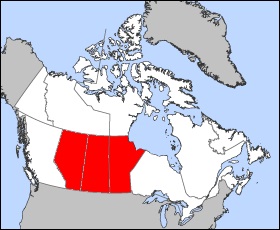
Map of Alberta Projection: Lambert azimuthal equal-area Geospatial data from: The Atlas of Canada, The National Atlas of the United States and U.S. Geological Survey Cartographer: John Fowler Map of Saskatchewan Projection: Lambert azimuthal equal-area Geospatial data from: The Atlas of Canada, The National Atlas of the United States and U.S. Geological Survey Cartographer: John Fowler |
| Date | (UTC) |
| Source |
This file was derived from: |
| Author |
|
| This is a retouched picture, which means that it has been digitally altered from its original version. Modifications: combined red selected regions in all maps. The original can be viewed here: Saskatchewan-map.png:
|
Licensing
[edit]
| I, the copyright holder of this work, release this work into the public domain. This applies worldwide. In some countries this may not be legally possible; if so: I grant anyone the right to use this work for any purpose, without any conditions, unless such conditions are required by law. |
Original upload log
[edit]
This image is a derivative work of the following images:
- File:Alberta-map.png licensed with PD-self
- 2005-03-24T12:10:41Z Voyager 280x230 (14865 Bytes) Map of Alberta Projection: Lambert azimuthal equal-area Geospatial data from: [http://atlas.gc.ca/ The Atlas of Canada], [http://www.nationalatlas.gov/ The National Atlas of the United States] and [http://www.usgs.gov U.S.
- File:Manitoba-map.png licensed with PD-self
- 2005-03-24T12:12:50Z Voyager 280x230 (14829 Bytes) Map of Manitoba Projection: Lambert azimuthal equal-area Geospatial data from: [http://atlas.gc.ca/ The Atlas of Canada], [http://www.nationalatlas.gov/ The National Atlas of the United States] and [http://www.usgs.gov U.S.
- File:Saskatchewan-map.png licensed with PD-self
- 2005-03-24T12:18:27Z Voyager 280x230 (14852 Bytes) Map of Saskatchewan Projection: Lambert azimuthal equal-area Geospatial data from: [http://atlas.gc.ca/ The Atlas of Canada], [http://www.nationalatlas.gov/ The National Atlas of the United States] and [http://www.usgs.gov
File history
Click on a date/time to view the file as it appeared at that time.
| Date/Time | Thumbnail | Dimensions | User | Comment | |
|---|---|---|---|---|---|
| current | 01:29, 25 April 2014 | | 280 × 230 (27 KB) | ויקיג'אנקי (talk | contribs) | User created page with UploadWizard |
You cannot overwrite this file.
File usage on Commons
There are no pages that use this file.
File usage on other wikis
The following other wikis use this file:
- Usage on he.wikipedia.org
- Usage on he.wikivoyage.org