File:The Long Causeway - geograph.org.uk - 39664.jpg
Jump to navigation
Jump to search

Size of this preview: 800 × 600 pixels. Other resolutions: 320 × 240 pixels | 640 × 480 pixels | 1,024 × 768 pixels | 1,280 × 960 pixels | 1,600 × 1,200 pixels.
Original file (1,600 × 1,200 pixels, file size: 808 KB, MIME type: image/jpeg)
Captions
Captions
Add a one-line explanation of what this file represents
Summary
[edit]
| Description |
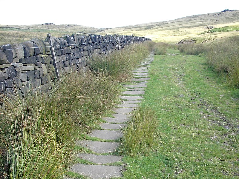
English: The Long Causeway. View west towards Withens Gate along the old packhouse route from Lumbutts to Withins Clough. This route is currently a permissive bridleway and forms part of the Calderdale Way. |
| Date | |
| Source | From geograph.org.uk |
| Author | Phil Champion |
| Attribution (required by the license) | Phil Champion / The Long Causeway / |
| Object location | | View this and other nearby images on: OpenStreetMap |
|---|
_&language=en)
Licensing
[edit]

|
This image was taken from the Geograph project collection. See this photograph's page on the Geograph website for the photographer's contact details. The copyright on this image is owned by Phil Champion and is licensed for reuse under the Creative Commons Attribution-ShareAlike 2.0 license.
|
This file is licensed under the Creative Commons Attribution-Share Alike 2.0 Generic license.
Attribution: Phil Champion
- You are free:
- to share – to copy, distribute and transmit the work
- to remix – to adapt the work
- Under the following conditions:
- attribution – You must give appropriate credit, provide a link to the license, and indicate if changes were made. You may do so in any reasonable manner, but not in any way that suggests the licensor endorses you or your use.
- share alike – If you remix, transform, or build upon the material, you must distribute your contributions under the same or compatible license as the original.
File history
Click on a date/time to view the file as it appeared at that time.
| Date/Time | Thumbnail | Dimensions | User | Comment | |
|---|---|---|---|---|---|
| current | 19:47, 10 February 2019 | | 1,600 × 1,200 (808 KB) | Geograph Update Bot (talk | contribs) | Higher-resolution version from Geograph. |
| 17:55, 30 January 2010 |  | 640 × 480 (120 KB) | GeographBot (talk | contribs) | == {{int:filedesc}} == {{Information |description={{en|1=The Long Causeway. View west towards Withens Gate along the old packhouse route from Lumbutts to Withins Clough. This route is currently a permissive bridleway and forms part of the Calderdale Way. |
You cannot overwrite this file.
File usage on Commons
The following page uses this file:
File usage on other wikis
The following other wikis use this file:
- Usage on en.wikipedia.org
- Usage on www.wikidata.org