File:The Fens England map.svg

Original file (SVG file, nominally 1,740 × 1,585 pixels, file size: 1.59 MB)
Captions
Captions
Summary[edit]
| Description |
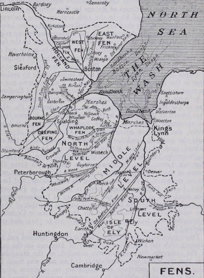
English: Map of The Fens England, places, levels, plains and and drains.
|
||||||||||||||
| Date | |||||||||||||||
| Source |
Own work based on: Information from:
|
||||||||||||||
| Author | Goran_tek-en | ||||||||||||||
| Permission (Reusing this file) |
This file is licensed under the Creative Commons Attribution-Share Alike 4.0 International license. Attribution: Goran_tek-en
|
||||||||||||||
| Other versions |
|
||||||||||||||
| SVG development | This vector image was created with Inkscape. |
||||||||||||||


| Object location | | View this and other nearby images on: OpenStreetMap |
|---|

File history
Click on a date/time to view the file as it appeared at that time.
| Date/Time | Thumbnail | Dimensions | User | Comment | |
|---|---|---|---|---|---|
| current | 12:22, 19 April 2024 | | 1,740 × 1,585 (1.59 MB) | Goran tek-en (talk | contribs) | aded city requested by MOTORAL1987 |
| 16:30, 18 April 2024 |  | 1,740 × 1,585 (1.59 MB) | Goran tek-en (talk | contribs) | added city requested by MOTORAL1987 | |
| 14:09, 18 April 2024 |  | 1,740 × 1,585 (1.58 MB) | Goran tek-en (talk | contribs) | added rivers requested by MOTORAL1987 | |
| 17:07, 16 April 2024 |  | 1,740 × 1,585 (1.58 MB) | Goran tek-en (talk | contribs) | added stuff requested by MOTORAL1987 | |
| 18:00, 15 April 2024 |  | 1,740 × 1,585 (1.57 MB) | Goran tek-en (talk | contribs) | stuff added as requested by MOTORAL1987 | |
| 15:20, 13 April 2024 |  | 1,740 × 1,585 (1.57 MB) | Goran tek-en (talk | contribs) | added village requested by MOTORAL1987 | |
| 15:42, 7 April 2024 |  | 1,740 × 1,585 (1.56 MB) | Goran tek-en (talk | contribs) | added villages, removed colors agreed with MOTORAL1987 | |
| 12:25, 1 April 2024 |  | 1,740 × 1,585 (1.69 MB) | Goran tek-en (talk | contribs) | {{Information |description ={{en|Map of The Fens England, places, levels, plains and and drains.}} {{Institution |wikidata=Q1404827}} |date =2024-04-01 |source ={{Own based|Map of The Fens.jpg|Map of the Fens.svg|b1=Lovell Johns Ltd|b2=Rcsprinter123}} {{Own}} <br> {{own using}} [https://www.openstreetmap.org/#map=10/53.0111/0.3694 OpenStreetMap]<br> *[https://johnknifton.files.wordpress.com/2018/05/fens.jpg johnknifton.files.wordpress.com] Information from: *[https://... |
You cannot overwrite this file.
File usage on Commons
The following 2 pages use this file:
File usage on other wikis
The following other wikis use this file: