File:Texas Historical Site Marker for Burr's Ferry at Sabine River Bridge on TX Hwy 63.jpg
Jump to navigation
Jump to search
Size of this preview: 702 × 599 pixels. Other resolutions: 281 × 240 pixels | 562 × 480 pixels | 900 × 768 pixels | 1,200 × 1,024 pixels | 1,380 × 1,178 pixels.
Original file (1,380 × 1,178 pixels, file size: 347 KB, MIME type: image/jpeg)
Captions
Captions
Add a one-line explanation of what this file represents
Summary[edit]
| Description |
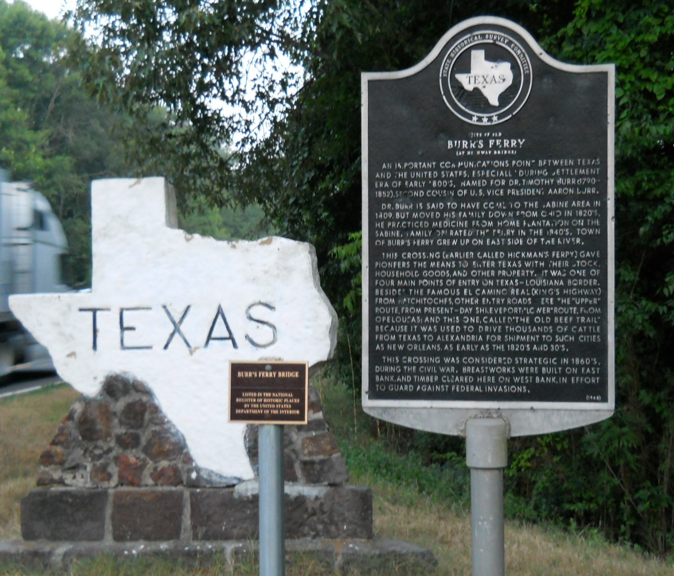
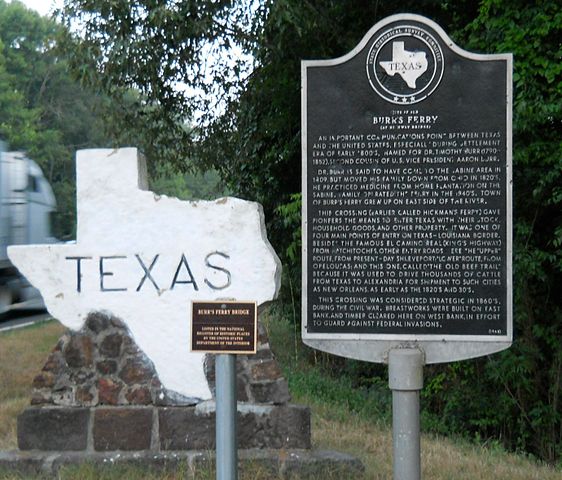
English: Burr's Ferry Texas Historical Marker commemorates the location of one of the key crossing points of the Sabine River, the boundary between Texas and Louisiana.
https://en.wikipedia.org/wiki/Burr%27s_Ferry_Bridge |
| Date | |
| Source | I took this photograph with my personal camera while travelling in Texas. |
| Author | HIM Nguyen |
Licensing[edit]
I, the copyright holder of this work, hereby publish it under the following licenses:

|
Permission is granted to copy, distribute and/or modify this document under the terms of the GNU Free Documentation License, Version 1.2 or any later version published by the Free Software Foundation; with no Invariant Sections, no Front-Cover Texts, and no Back-Cover Texts. A copy of the license is included in the section entitled GNU Free Documentation License. |
This file is licensed under the Creative Commons Attribution-Share Alike 3.0 Unported license.
- You are free:
- to share – to copy, distribute and transmit the work
- to remix – to adapt the work
- Under the following conditions:
- attribution – You must give appropriate credit, provide a link to the license, and indicate if changes were made. You may do so in any reasonable manner, but not in any way that suggests the licensor endorses you or your use.
- share alike – If you remix, transform, or build upon the material, you must distribute your contributions under the same or compatible license as the original.
You may select the license of your choice.
File history
Click on a date/time to view the file as it appeared at that time.
| Date/Time | Thumbnail | Dimensions | User | Comment | |
|---|---|---|---|---|---|
| current | 11:56, 27 July 2013 | | 1,380 × 1,178 (347 KB) | HIM Nguyen (talk | contribs) | {{subst:Upload marker added by en.wp UW}} {{Information |Description = {{en|Burr's Ferry Texas Historical Marker commemorates the location of one of the key crossing points of the Sabine River, the boundary between Texas and Louisiana. [[:en:https://... |
You cannot overwrite this file.
File usage on Commons
The following page uses this file:
File usage on other wikis
The following other wikis use this file:
- Usage on en.wikipedia.org
- Usage on www.wikidata.org
Metadata
Categories:
- Burr's Ferry Bridge
- State Historical Survey Committee plaques
- Plaques referencing 1809 in the United States
- Plaques referencing the 1800s in the United States
- Plaques referencing the 1820s in the United States
- Plaques referencing the 1830s in the United States
- Plaques referencing the 1860s in the United States
- Signs in Newton County, Texas
- Maps of Texas in art
- Louisiana-Texas border
- Signs in Texas